Marafa Hell’s Kitchen, Kenya: The Complete Travel Guide to Nyari, Its Sandstone Canyons, Giriama Heritage, Local Legends and Visitor Experience
Antony Trivet Photography | Kenya Travel Documentary Series | Kilifi County, Kenya
Introduction: Discovering Marafa Hell’s Kitchen
Kenya’s coastline is internationally recognised for its white-sand beaches, coral reefs, historic Swahili settlements and warm Indian Ocean waters. Yet inland from the familiar coastal holiday destinations lies a landscape that looks almost entirely disconnected from the tropical image commonly associated with this part of the country.
In Marafa, within Kilifi County, an extraordinary geological landscape of eroded sandstone, deep gullies, towering ridges and naturally sculpted rock formations creates one of coastal Kenya’s most unusual destinations.
Known internationally as Marafa Hell’s Kitchen, the attraction is also known locally as Nyari, a name associated with the Giriama community.
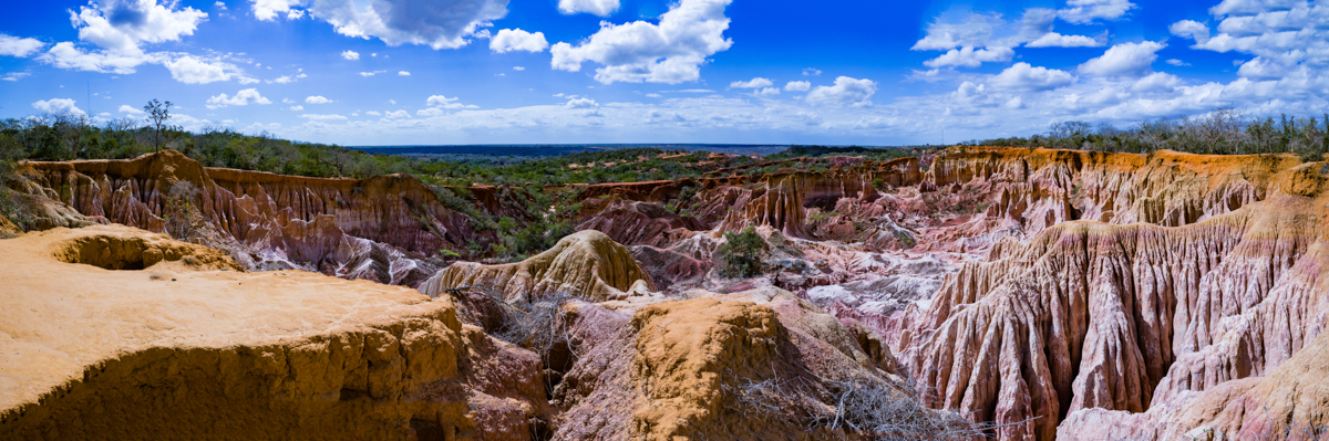
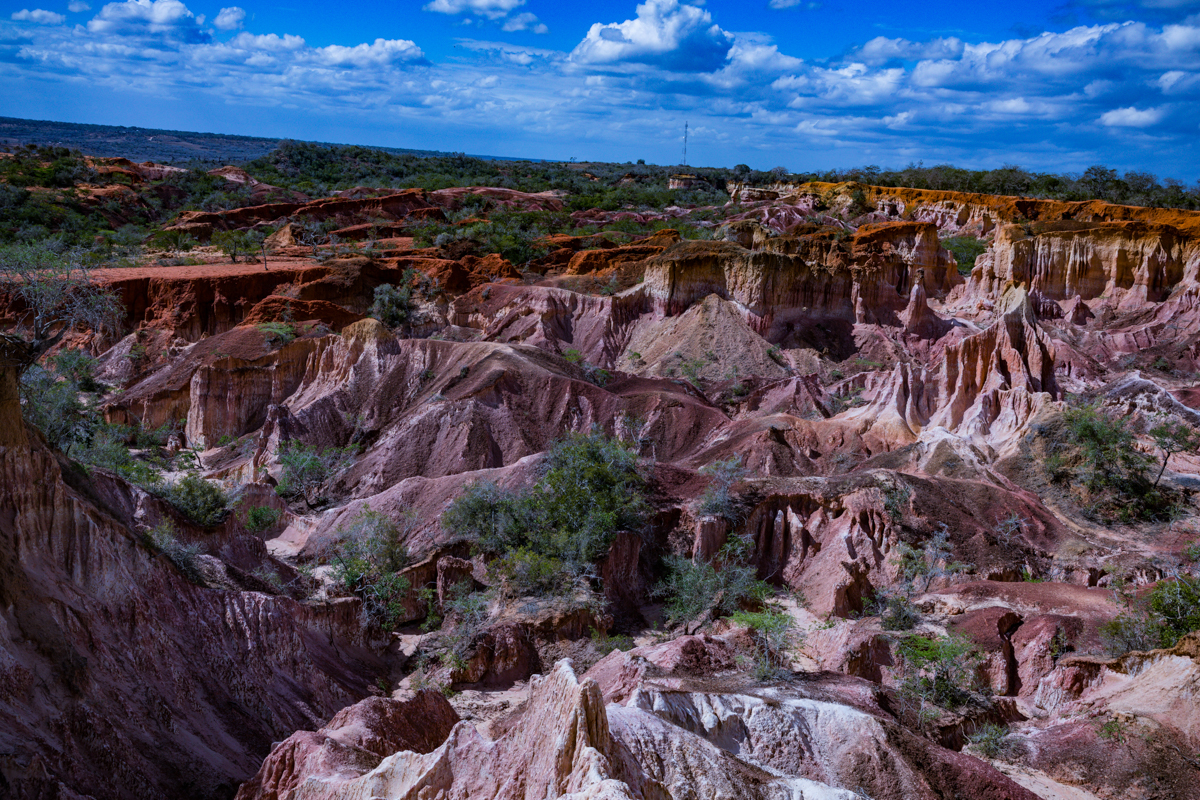
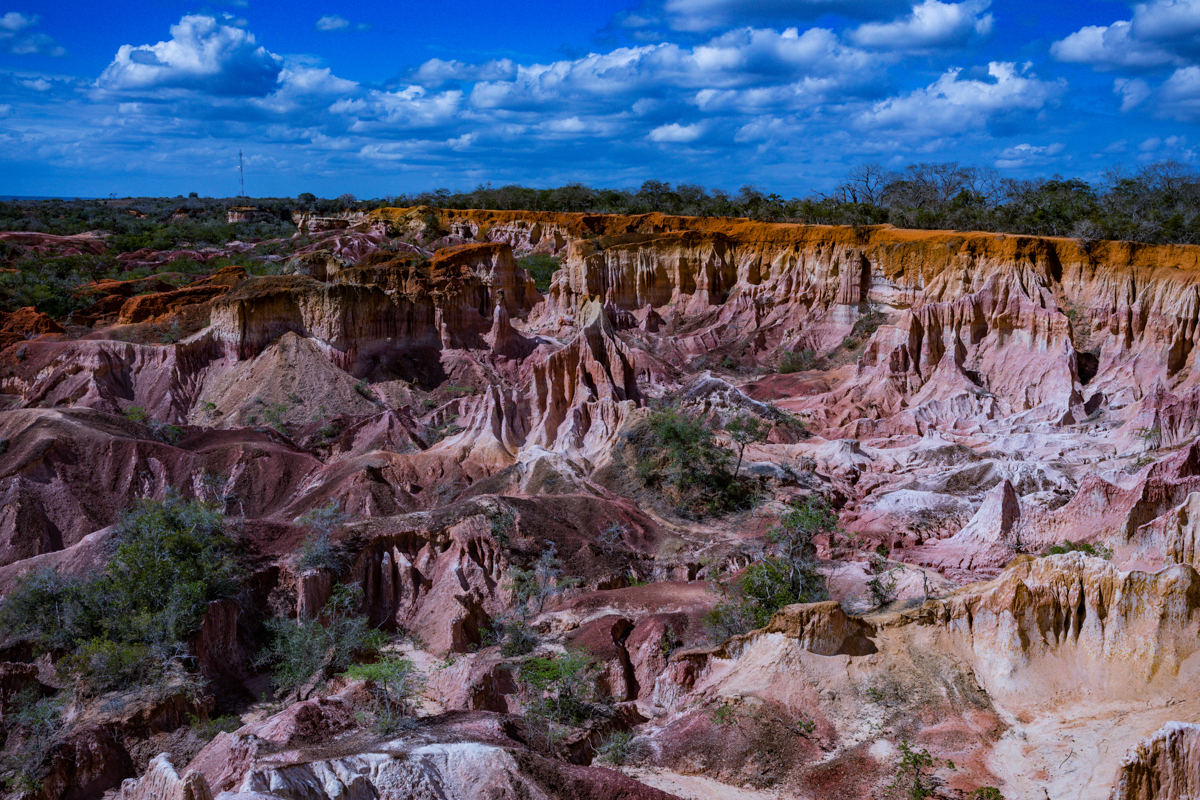
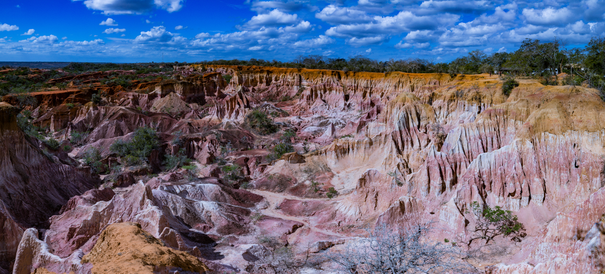
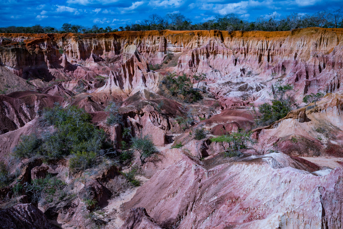
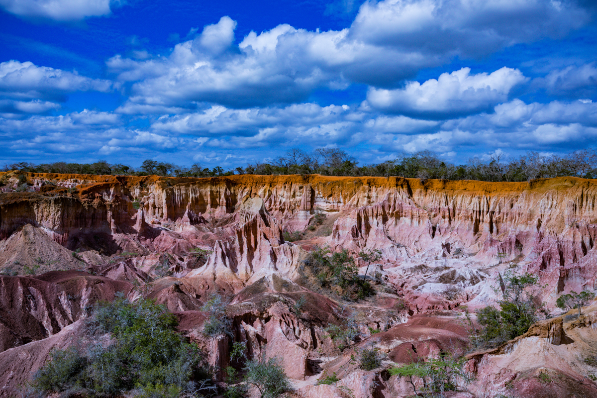
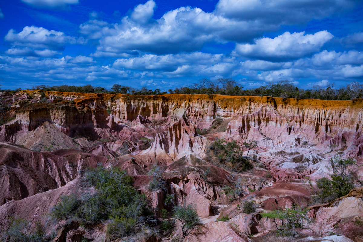
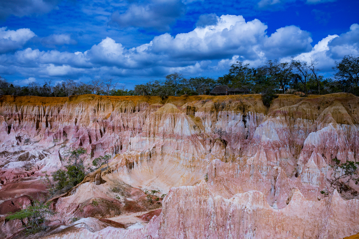
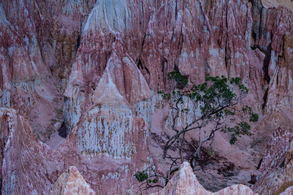
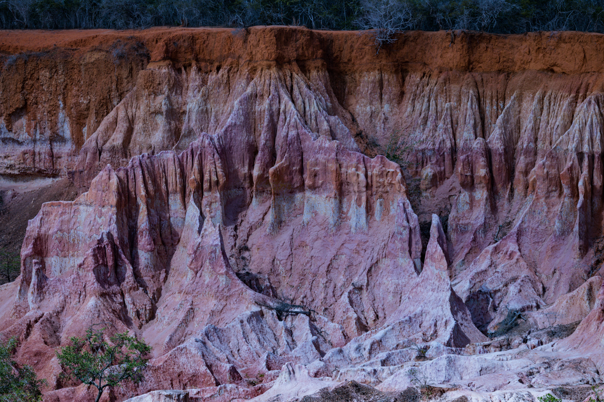
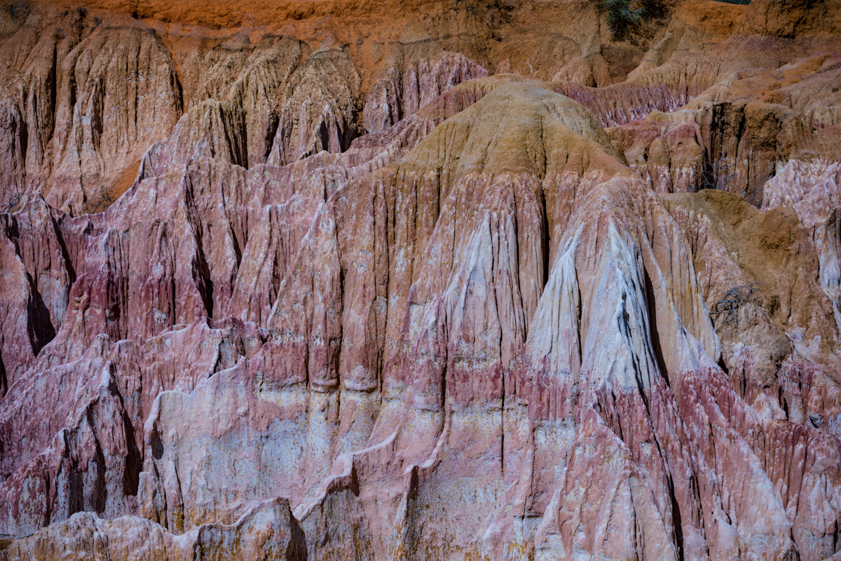
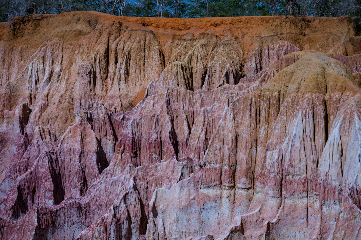
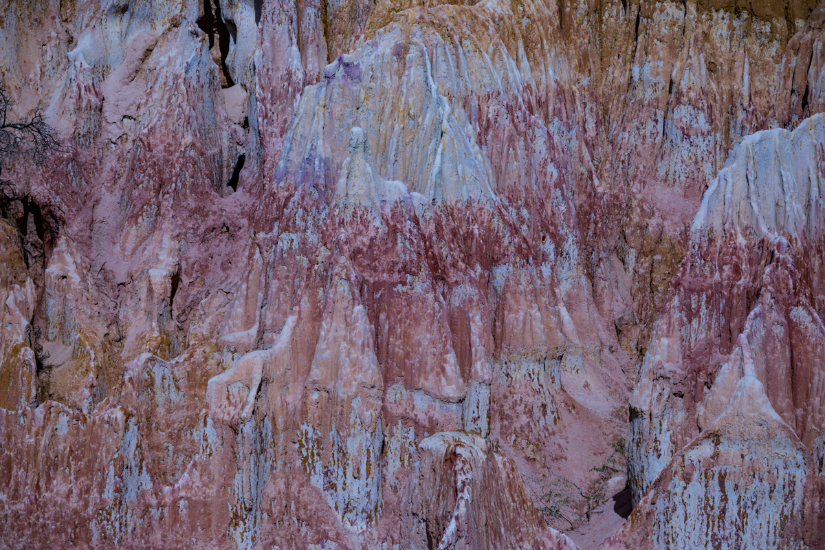
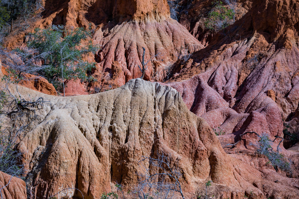
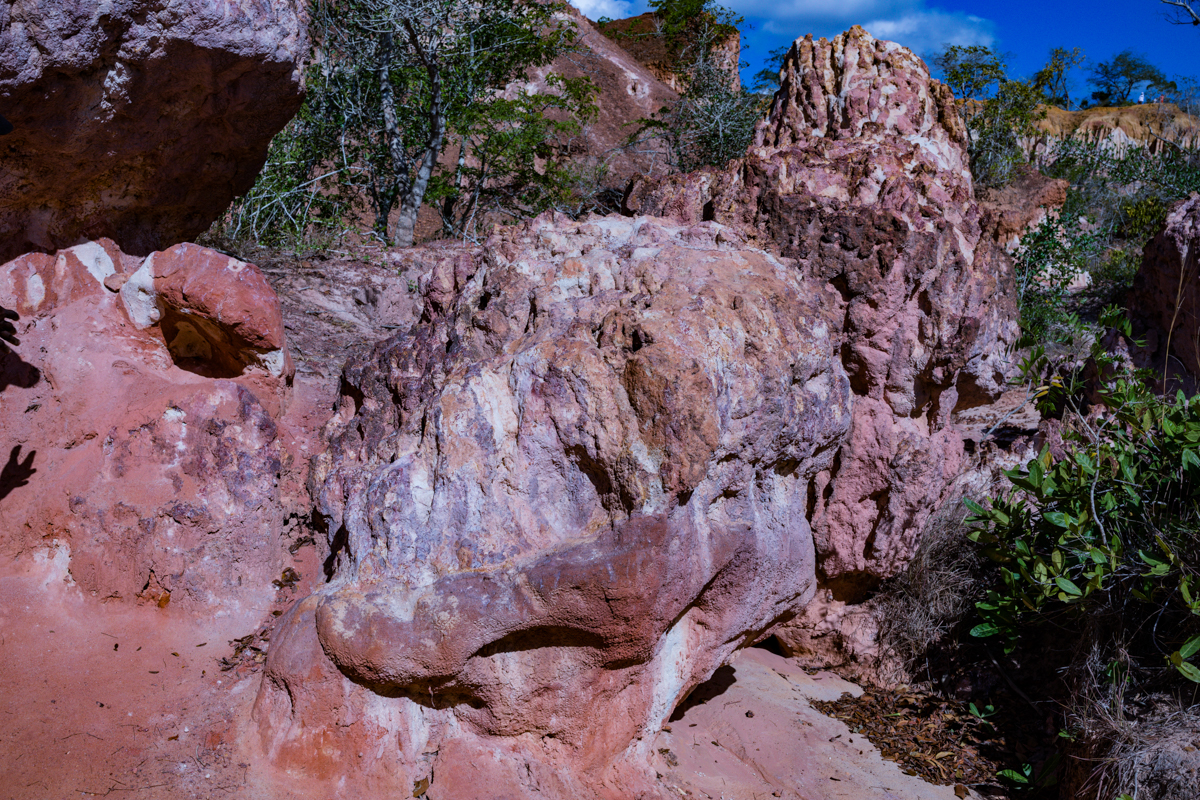
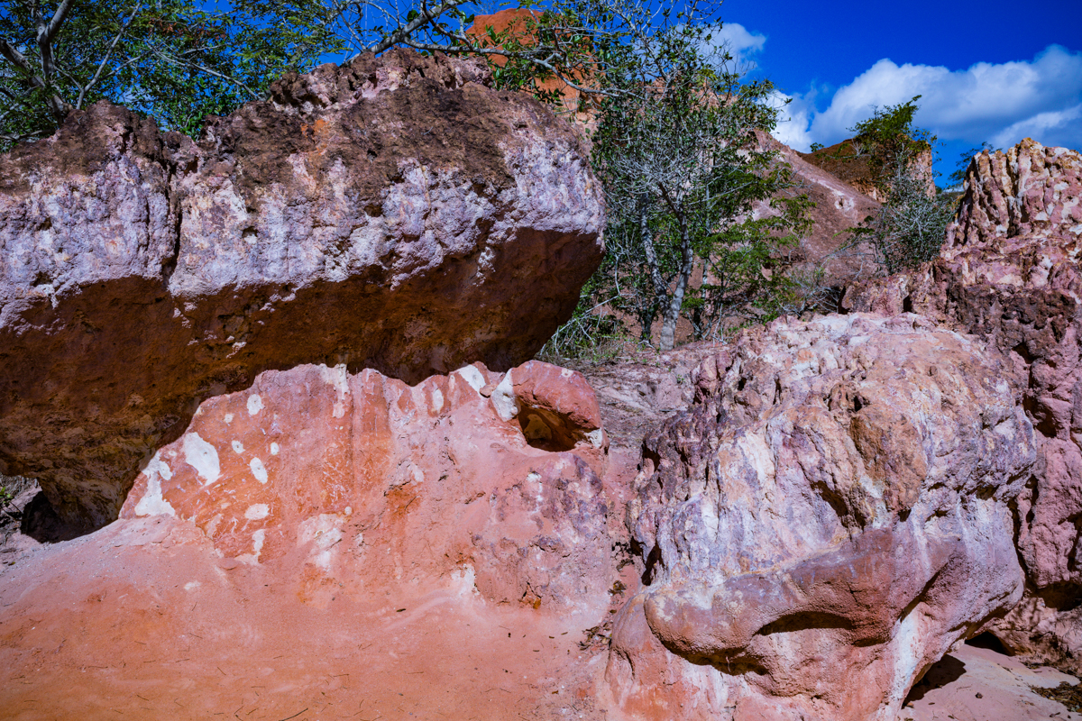
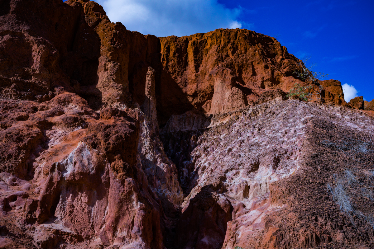
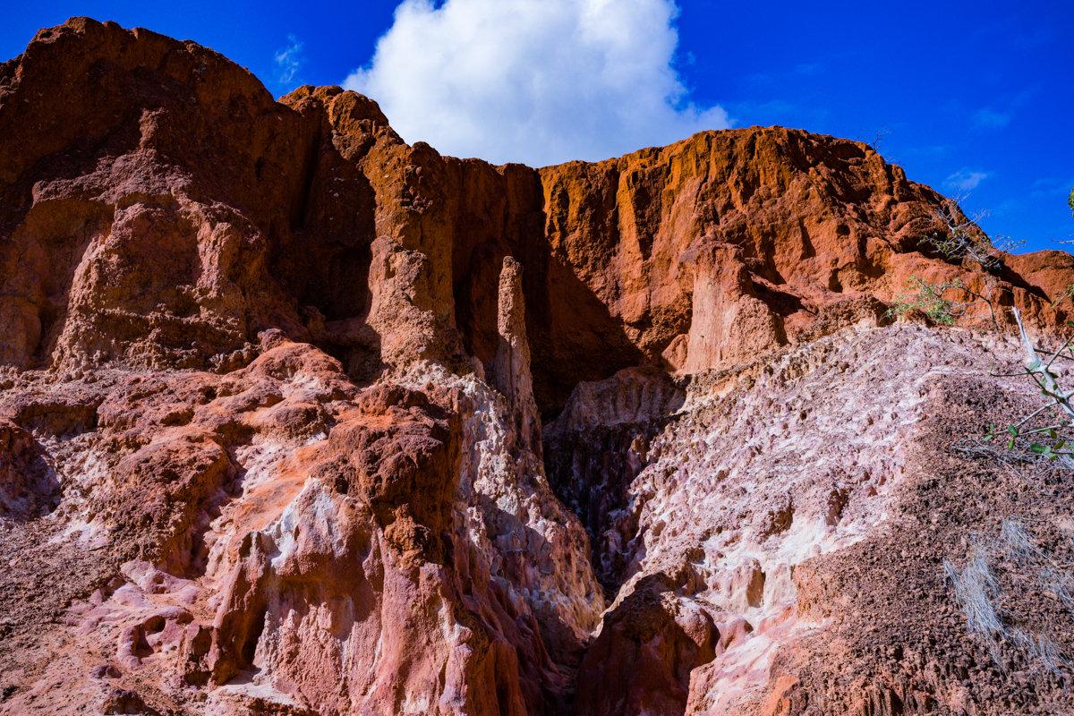
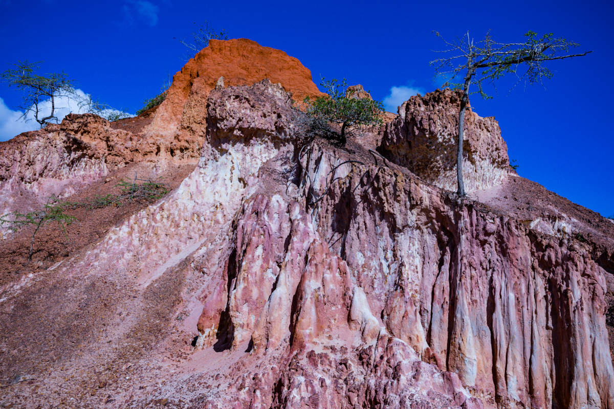
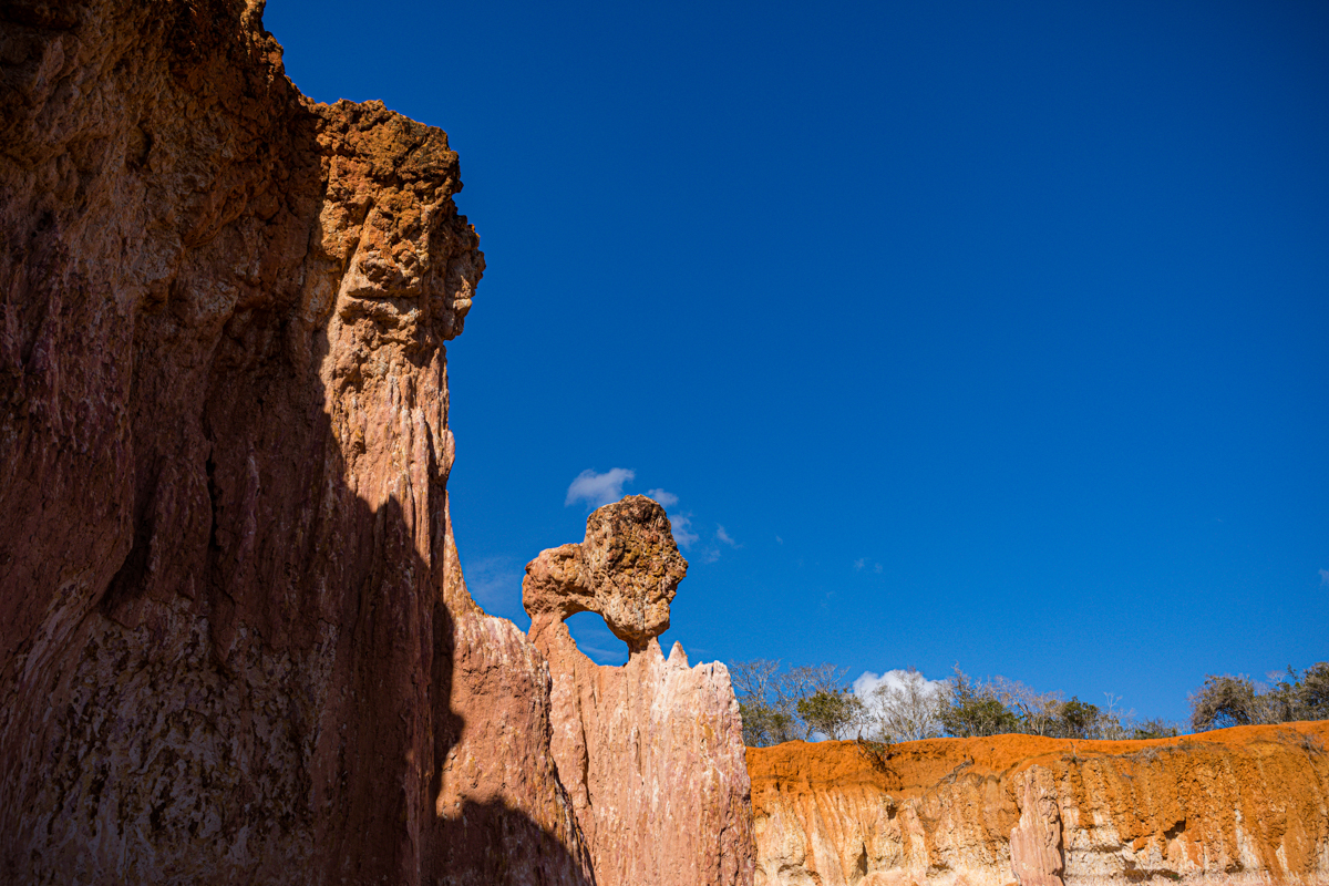
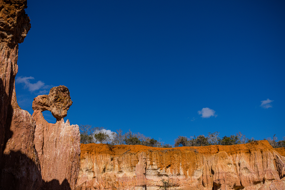
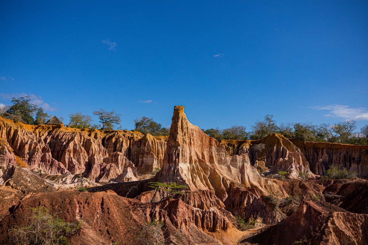
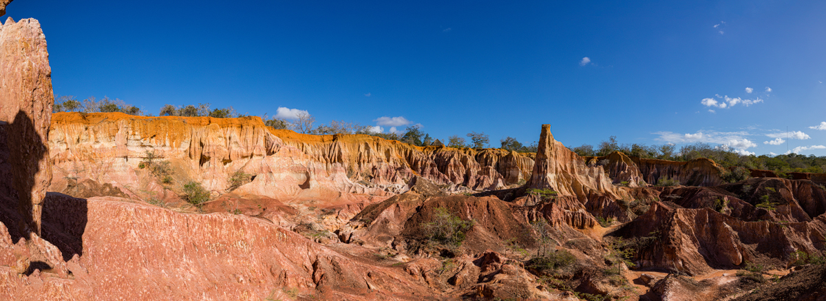
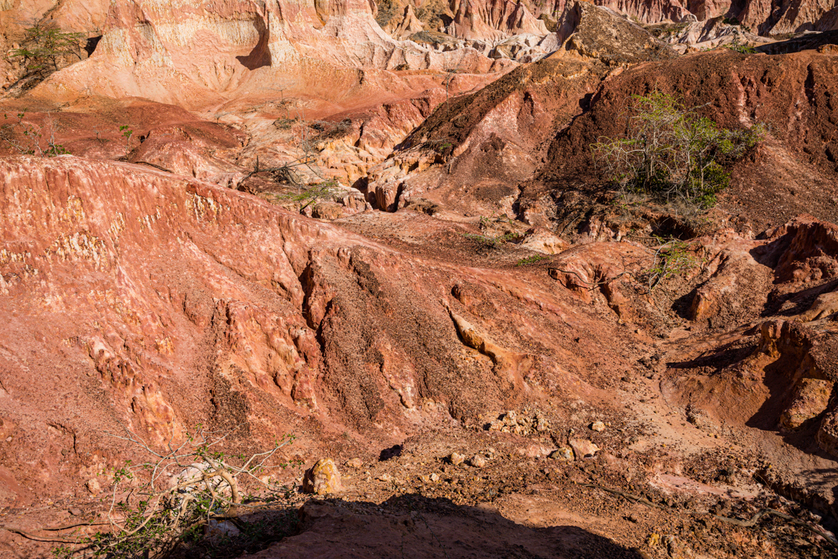
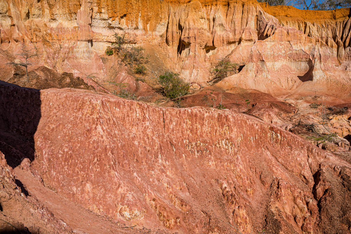
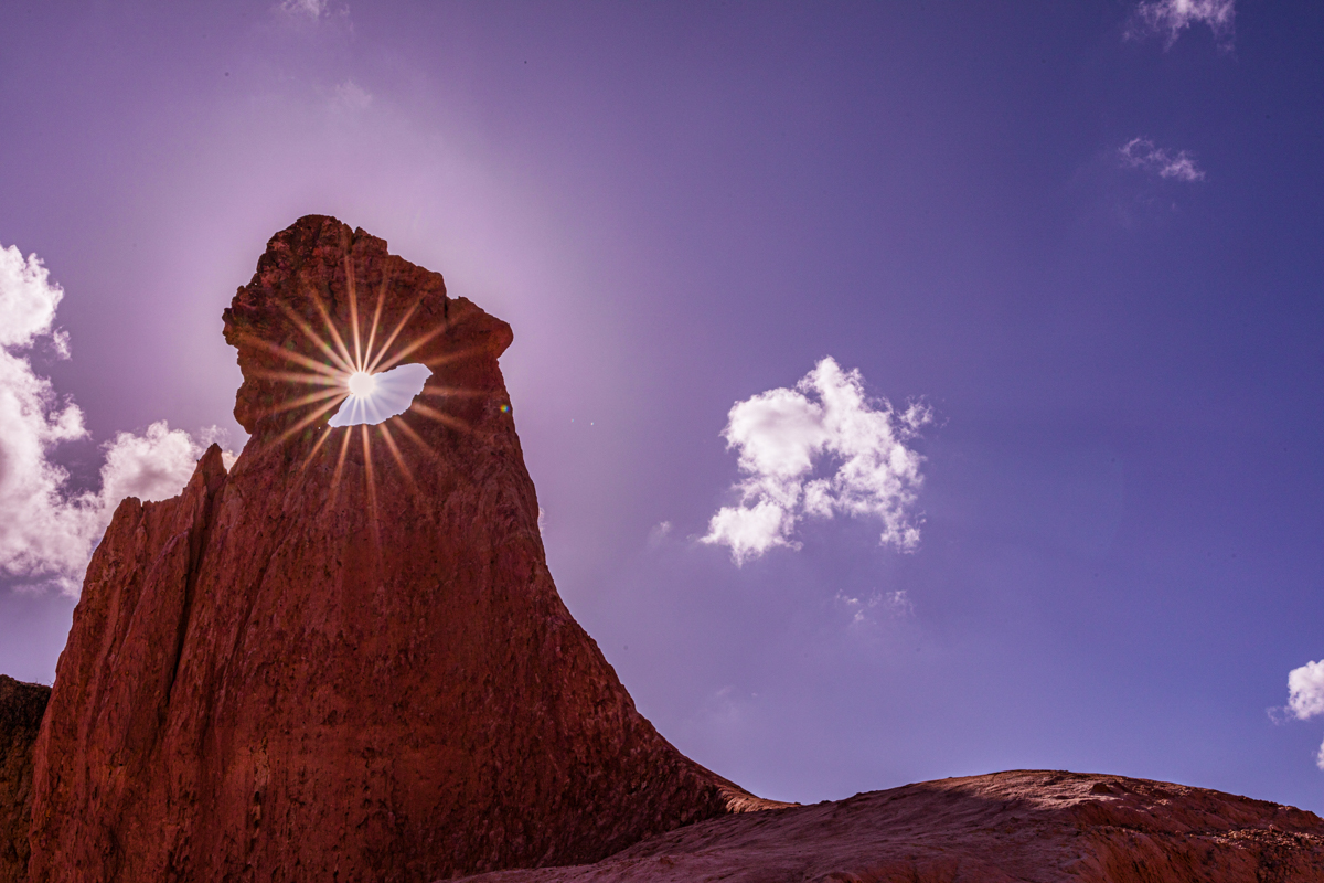
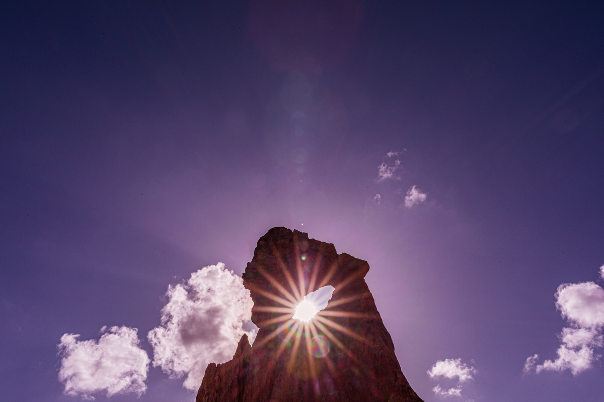
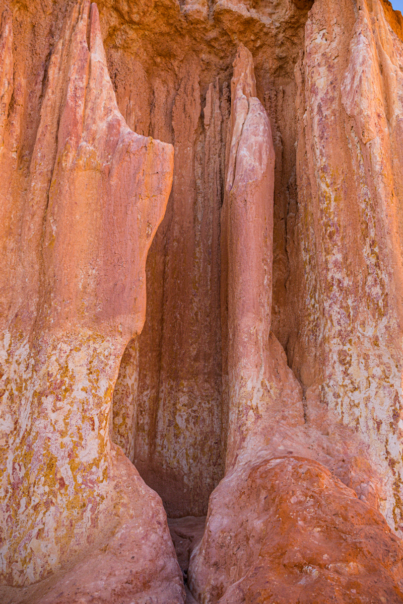
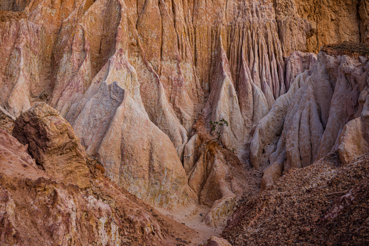
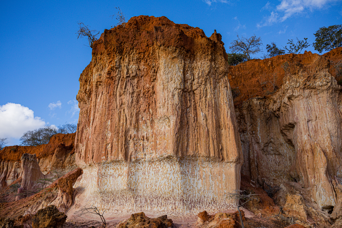
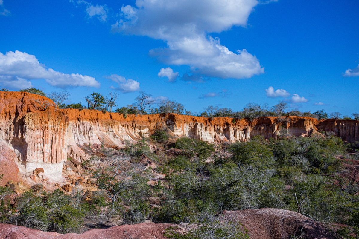
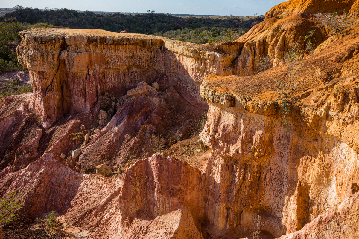
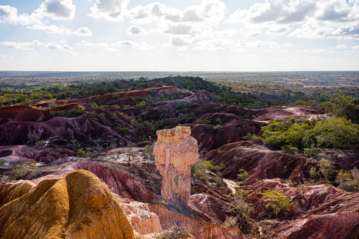
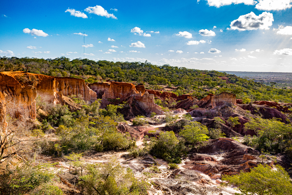
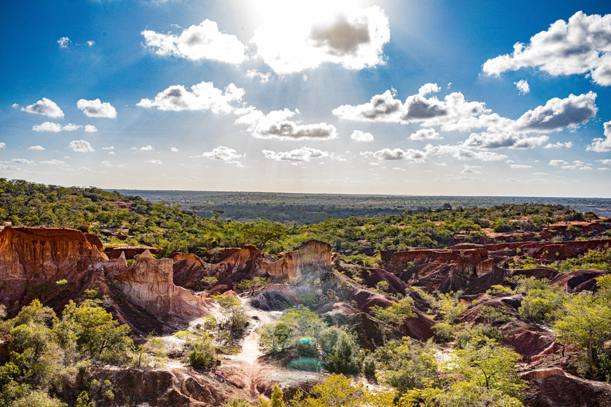
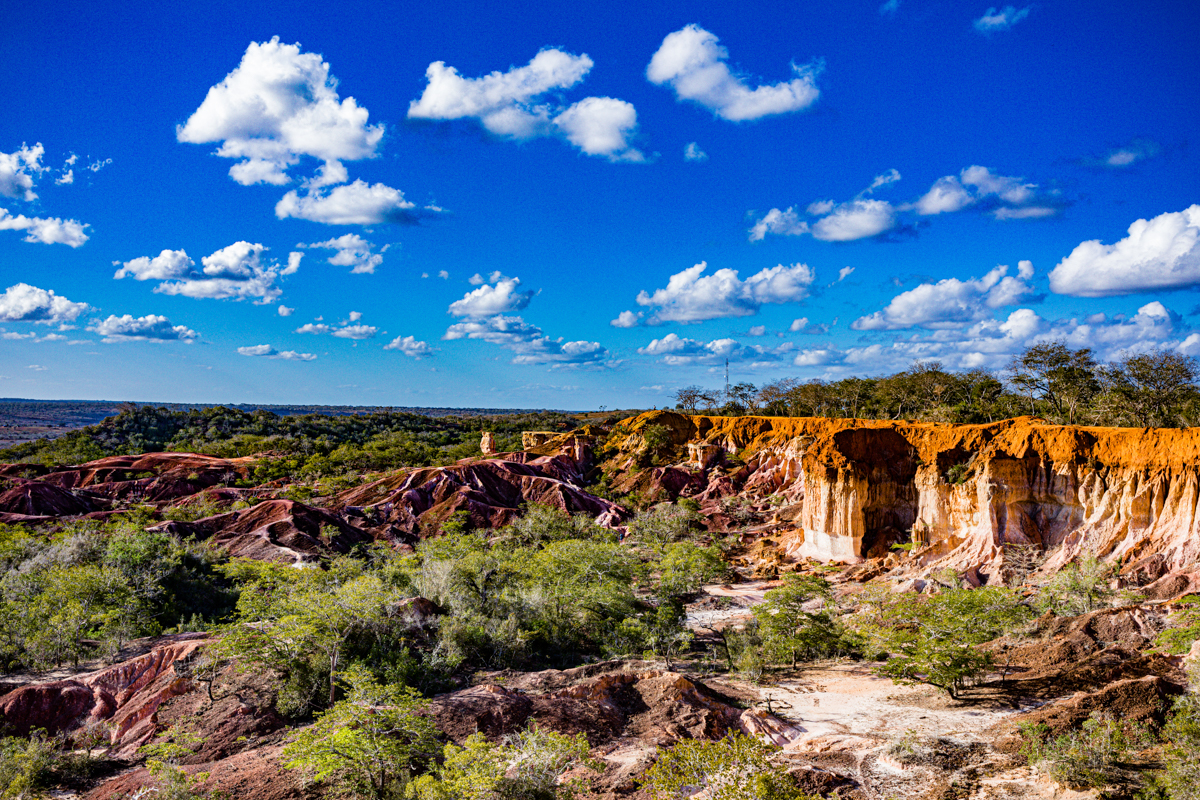
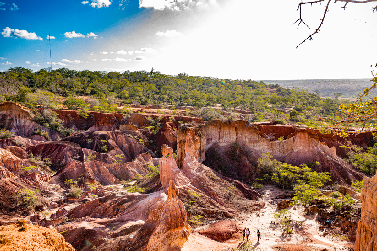
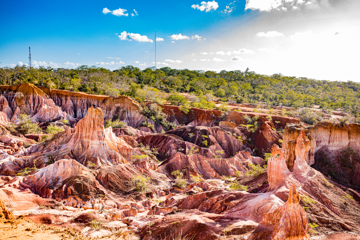
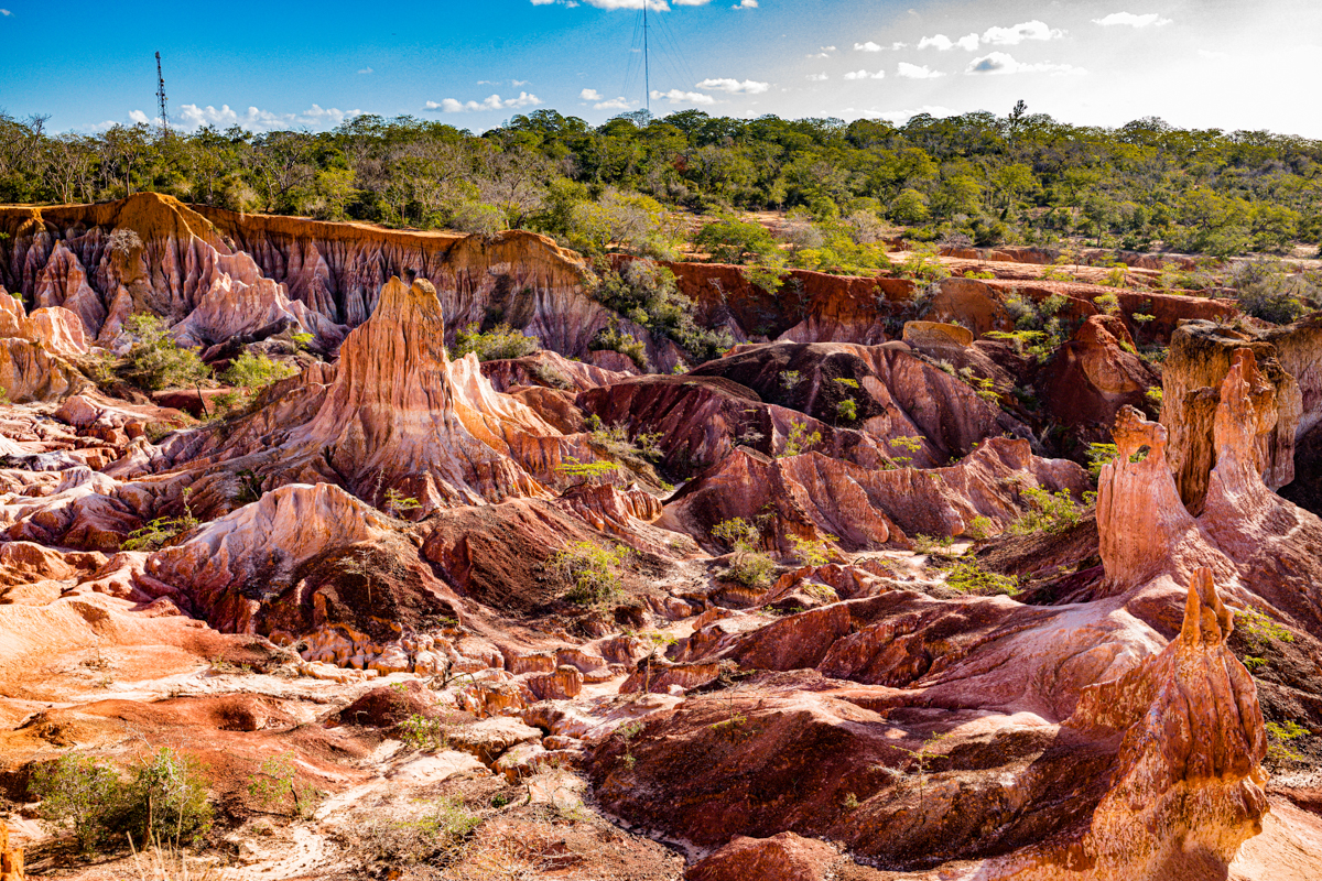
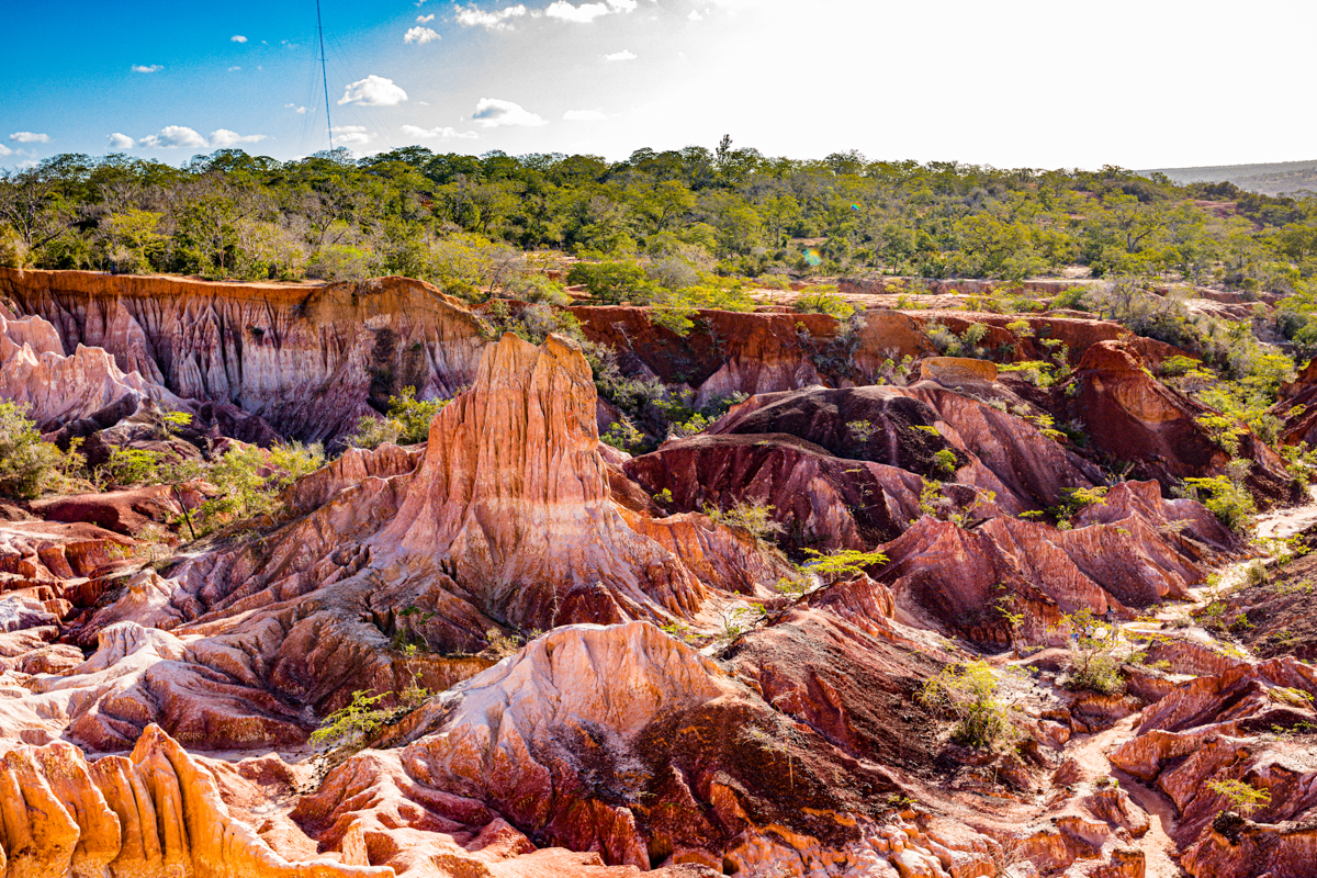
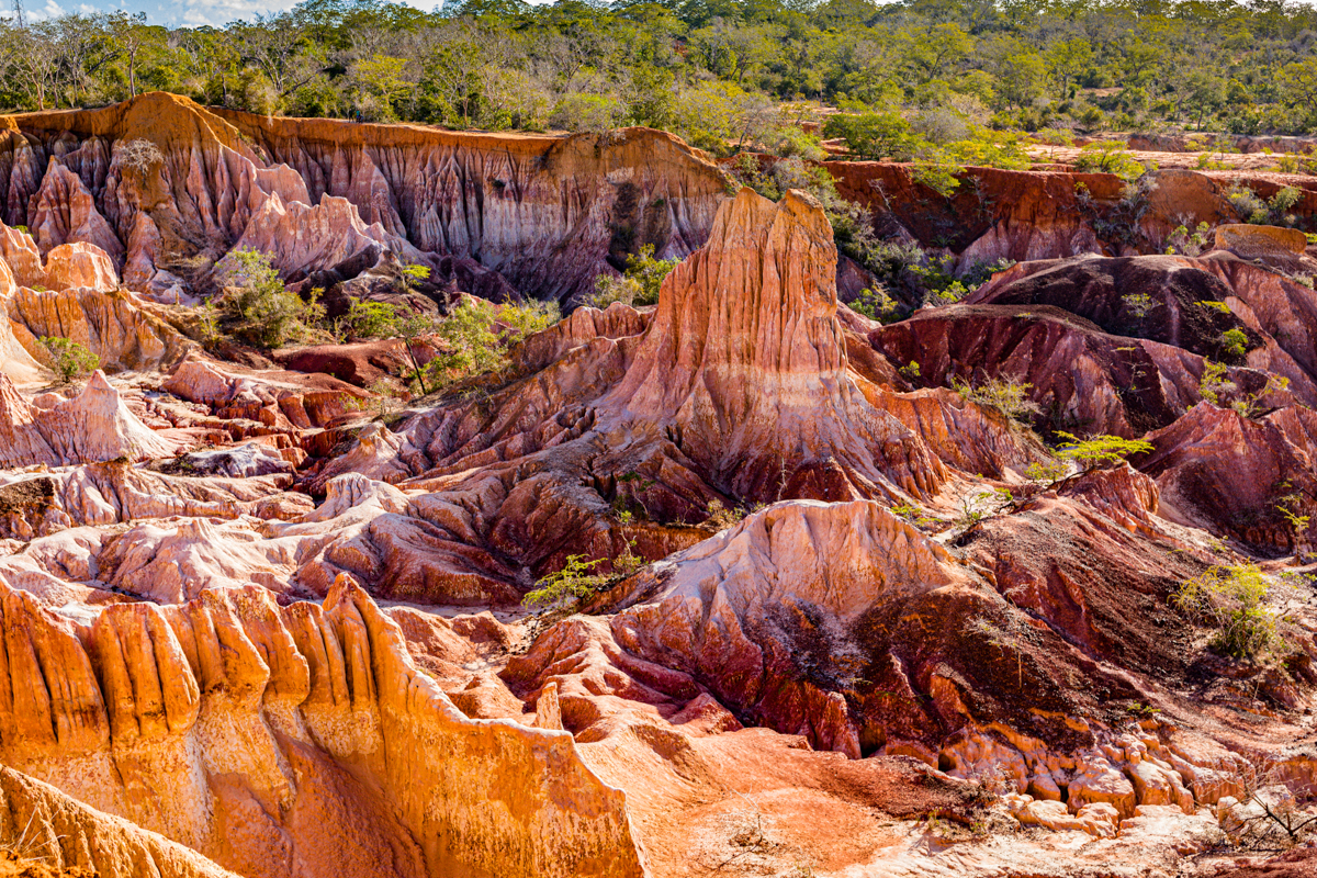
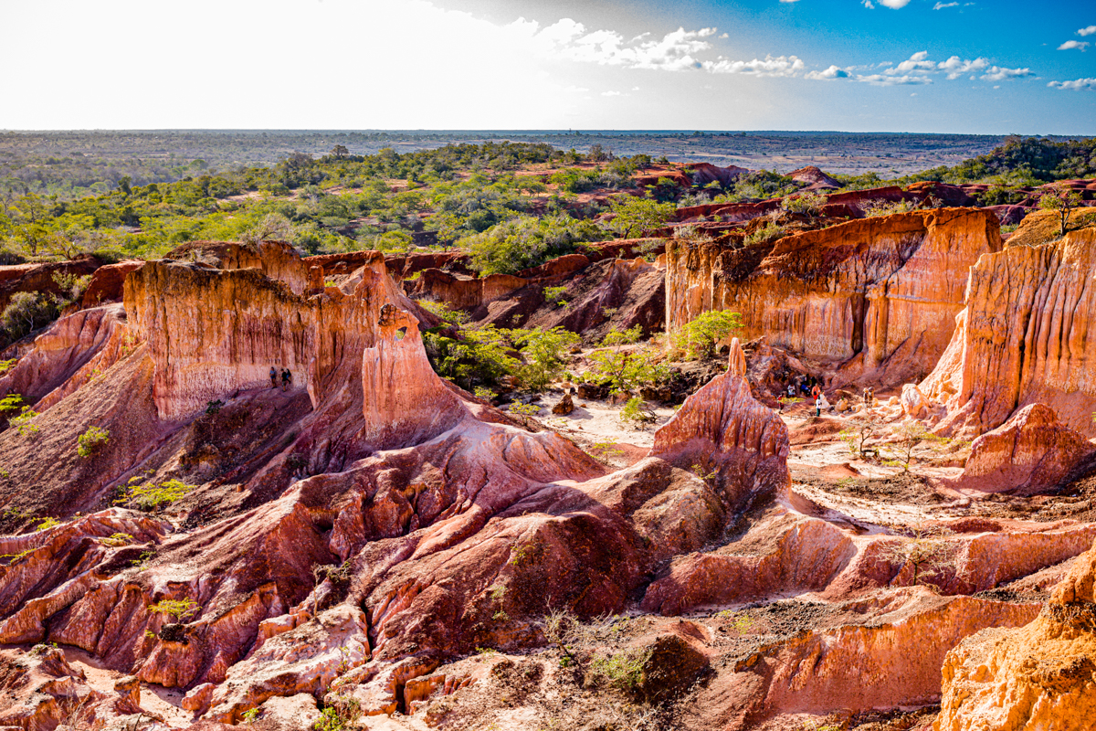
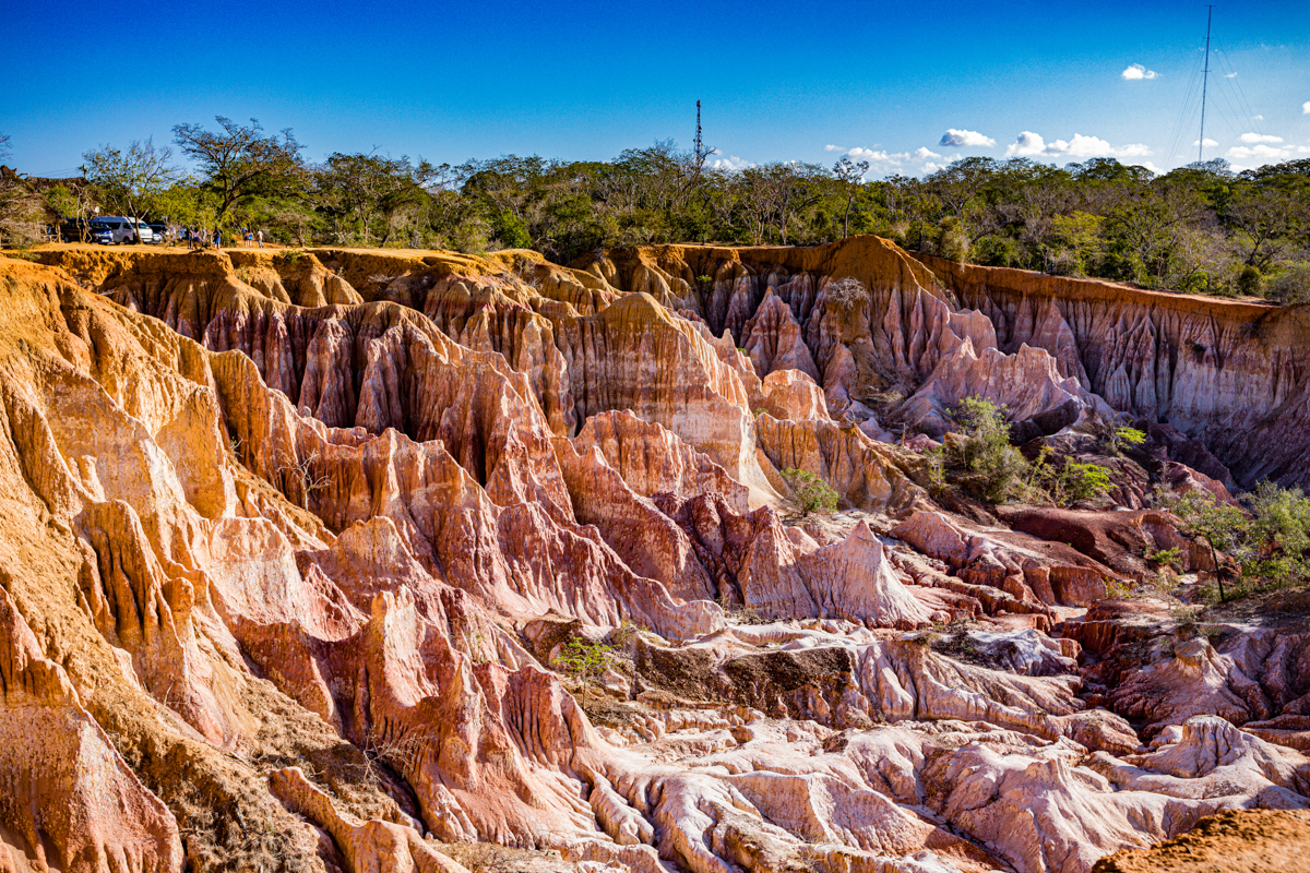
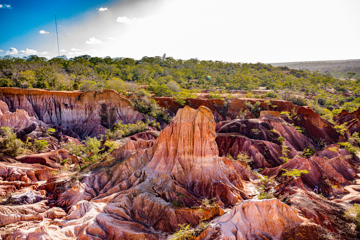
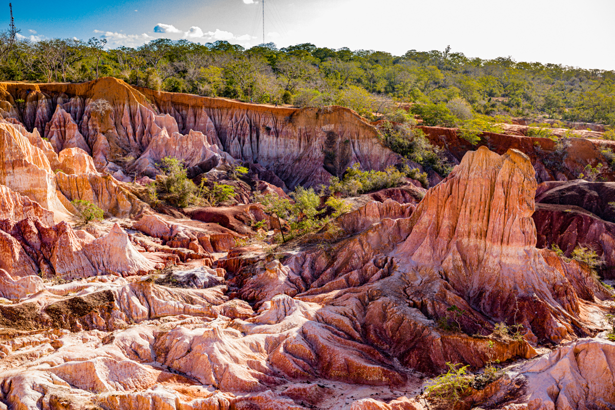
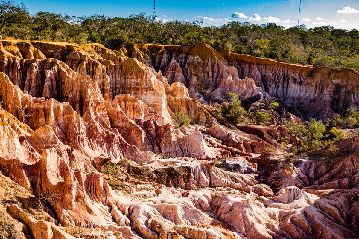
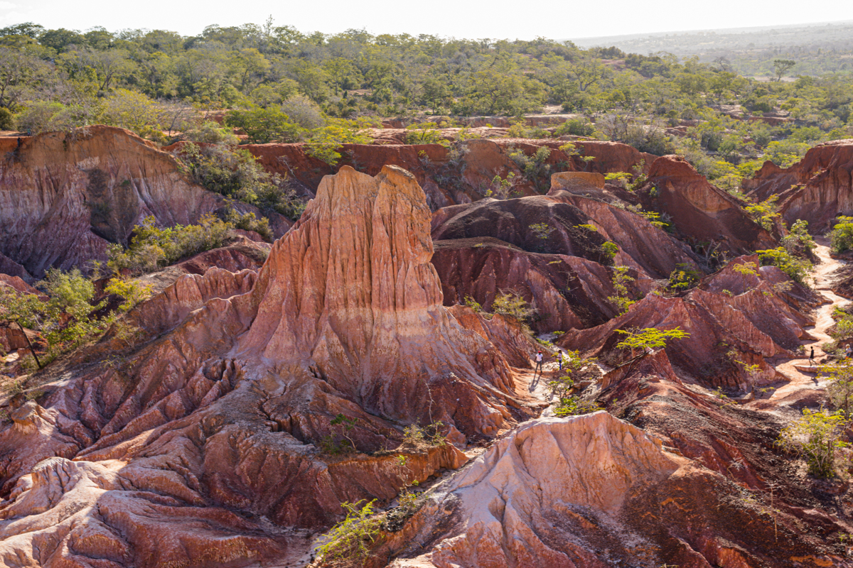
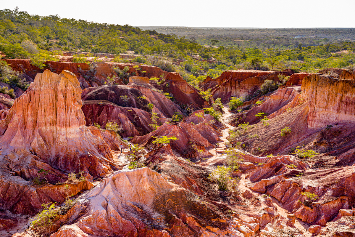
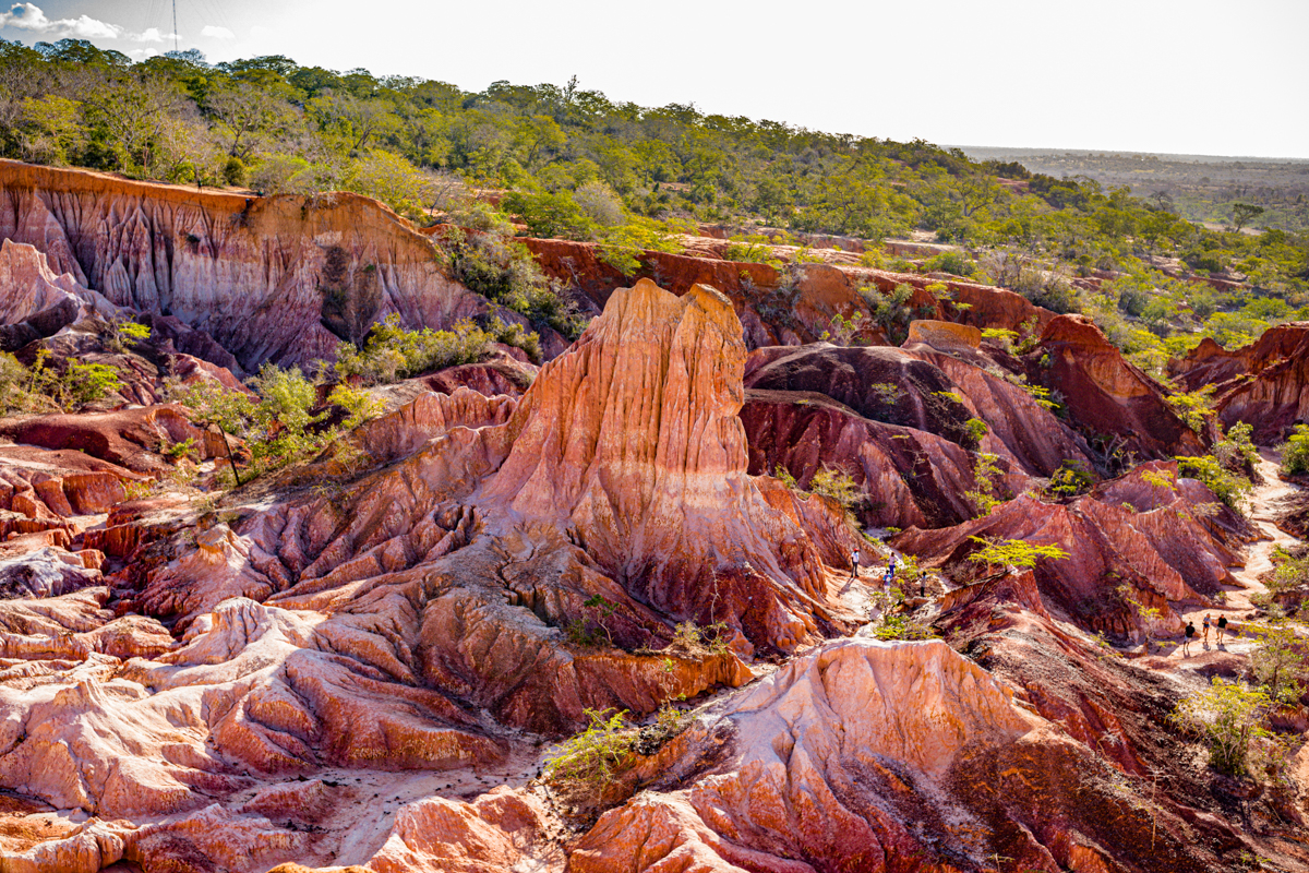
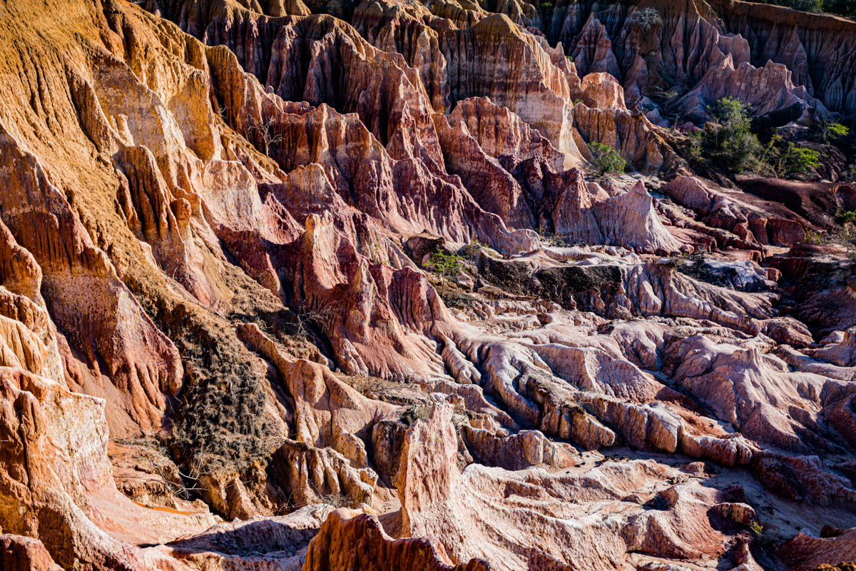
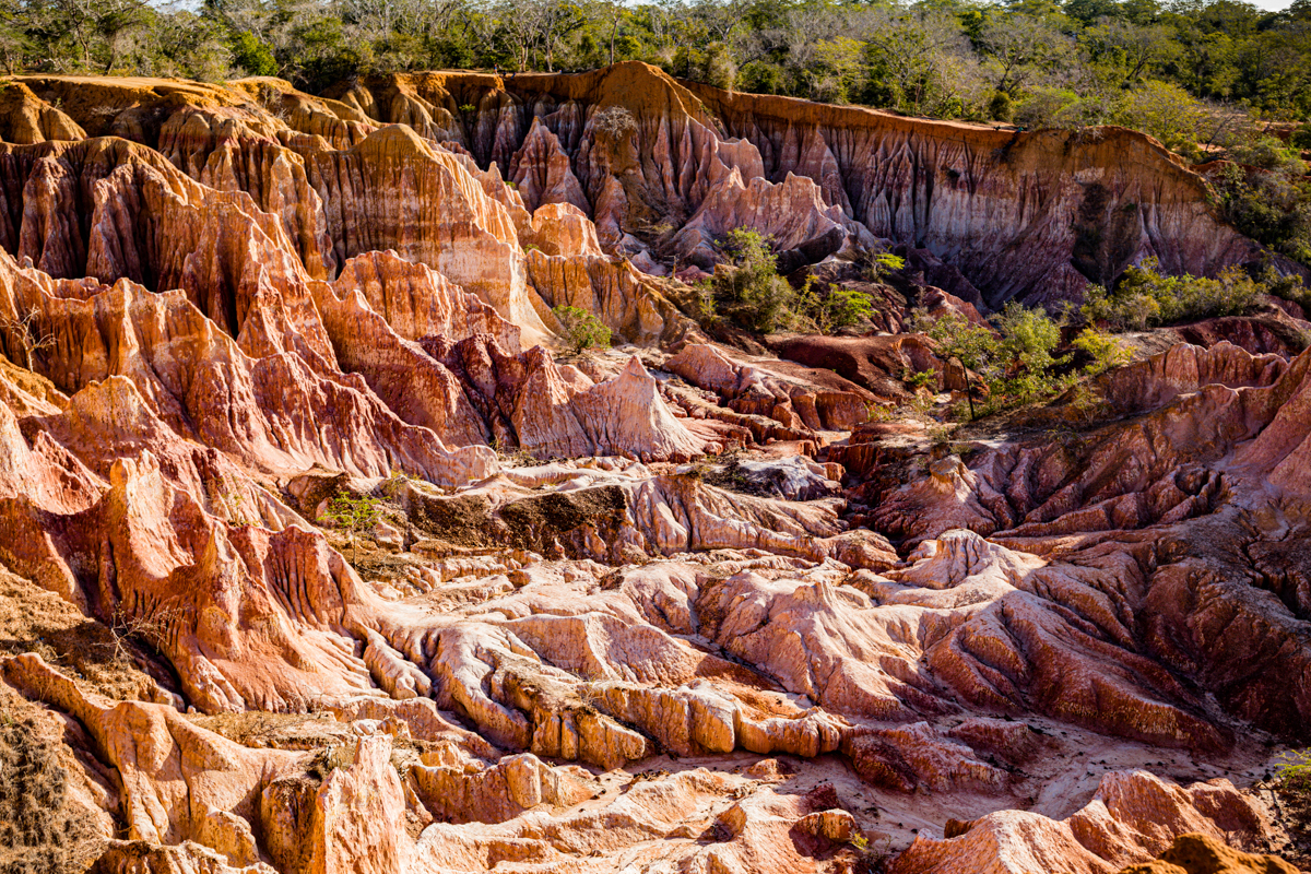
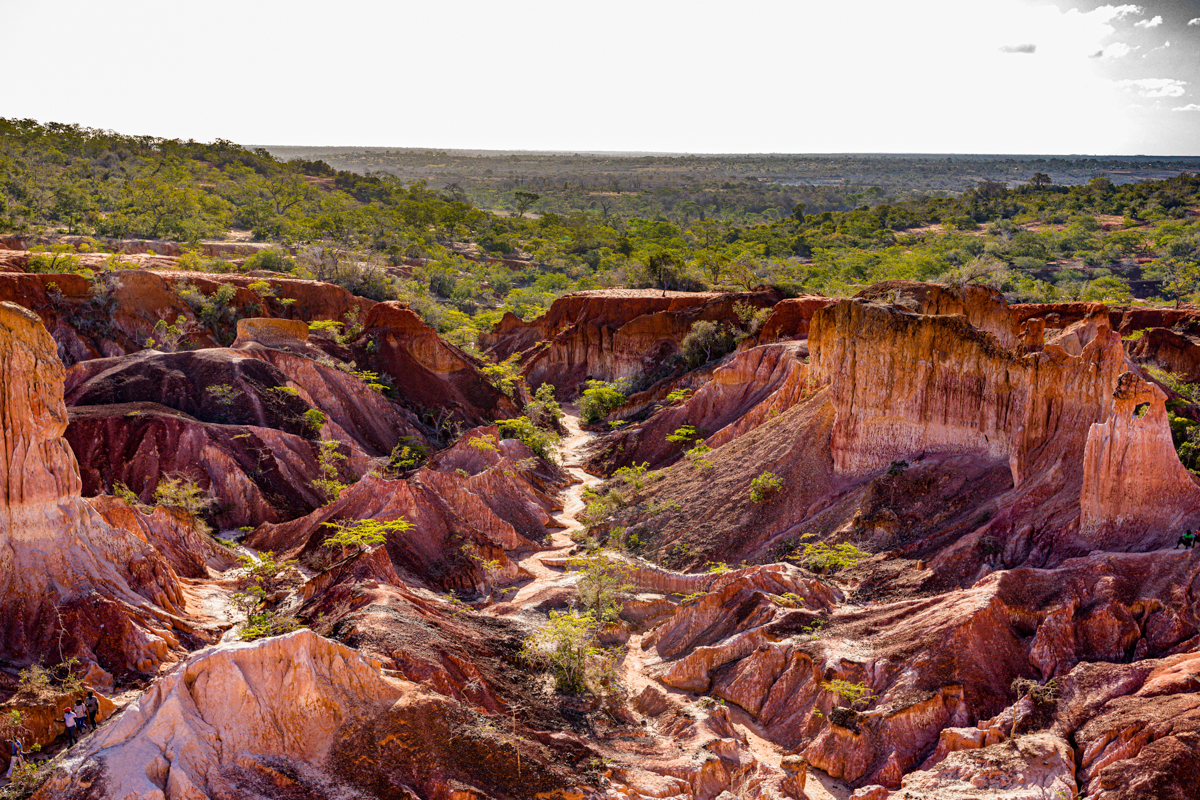
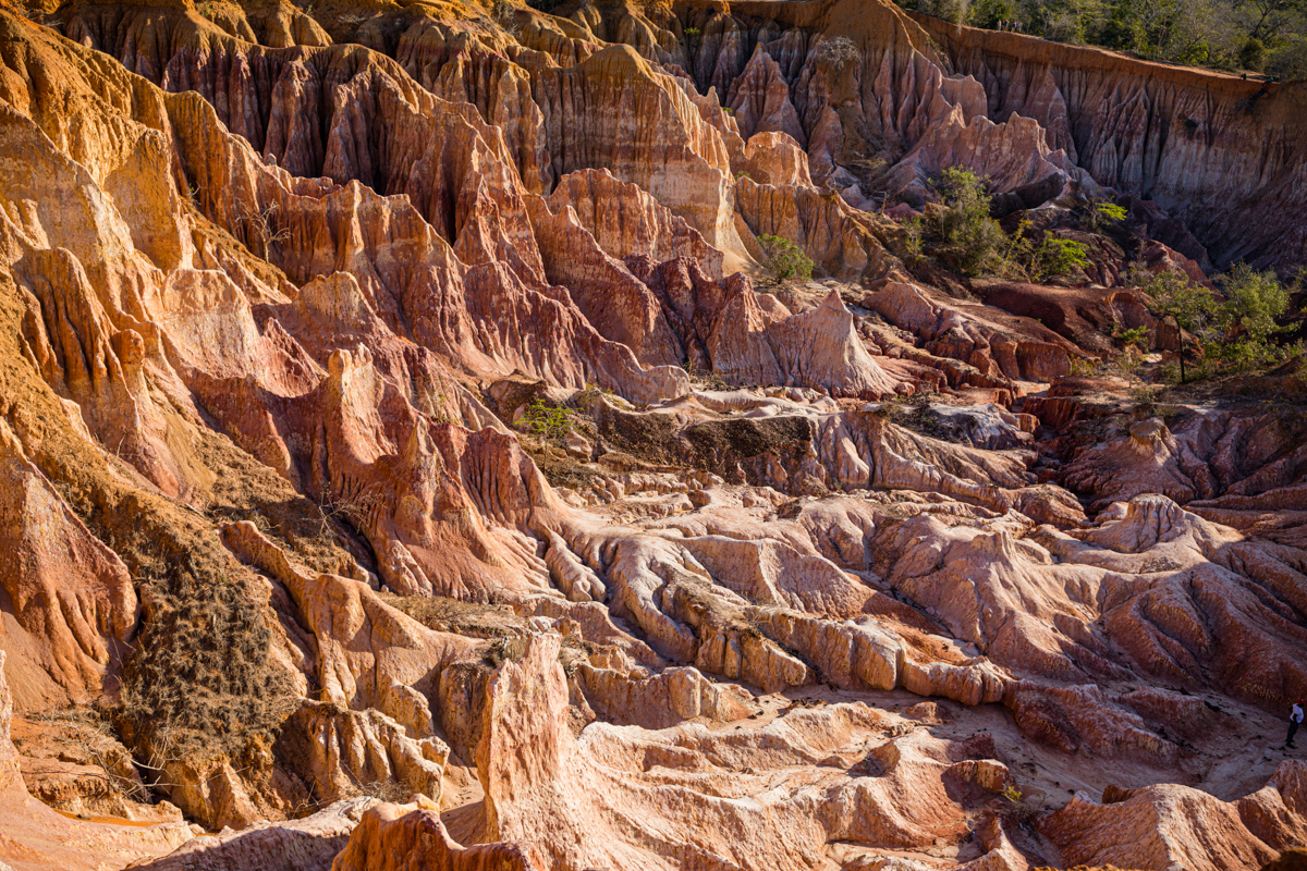
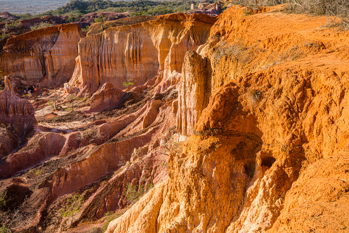
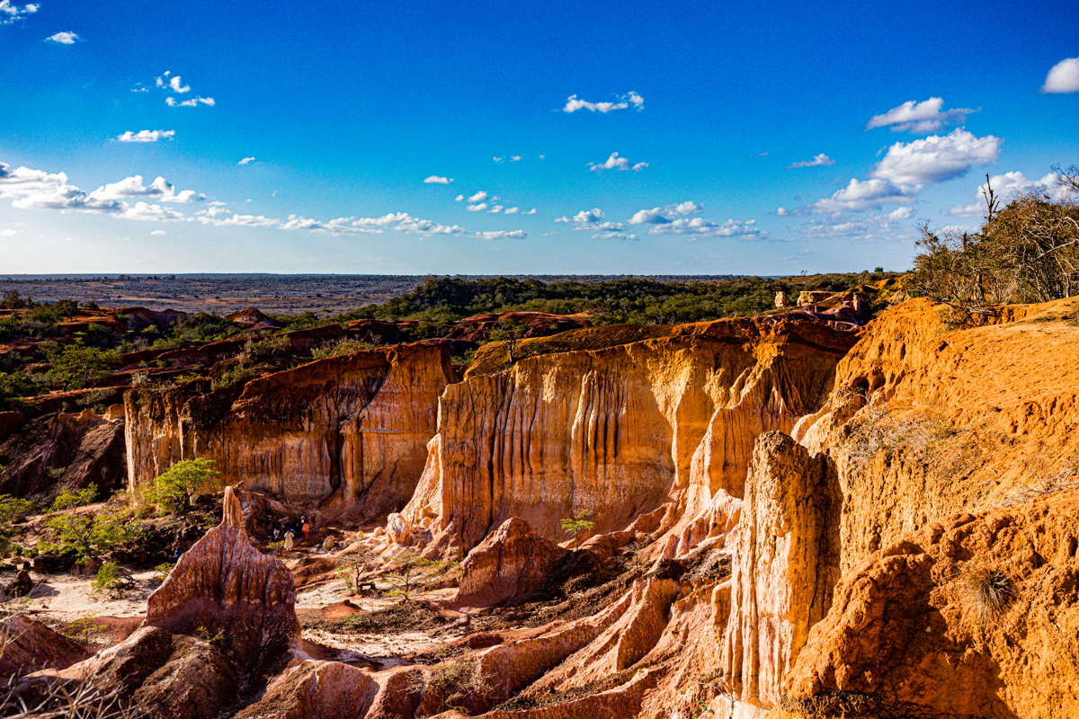
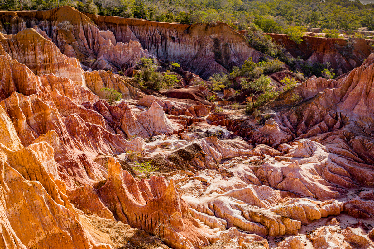
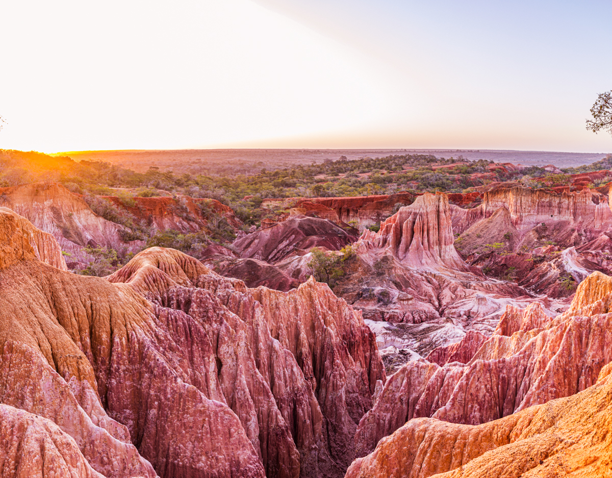
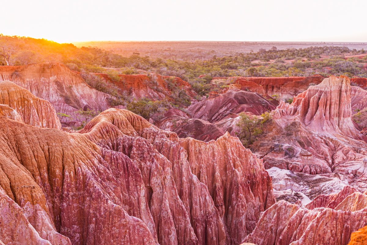
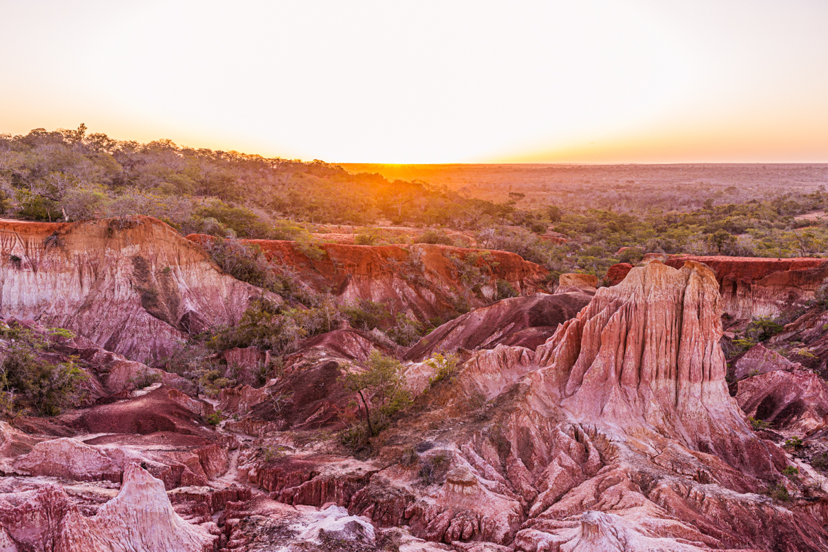
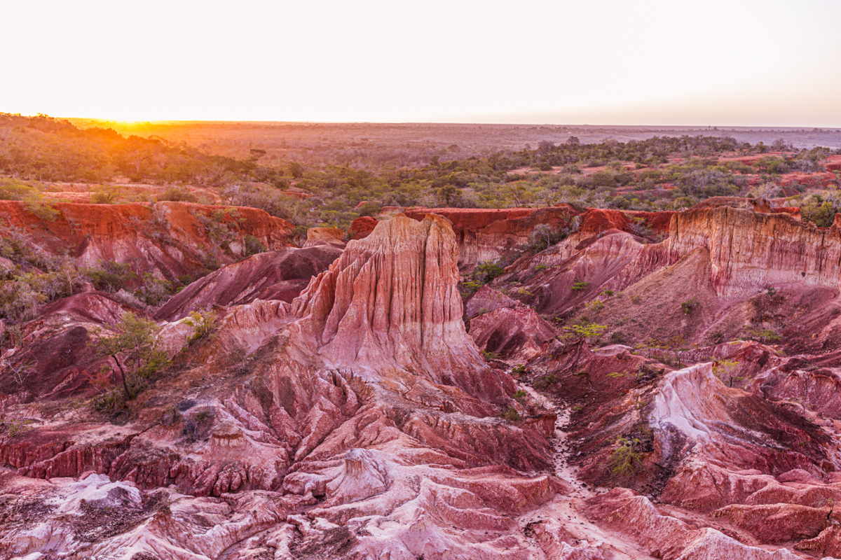
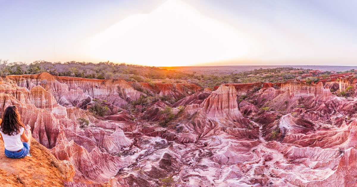
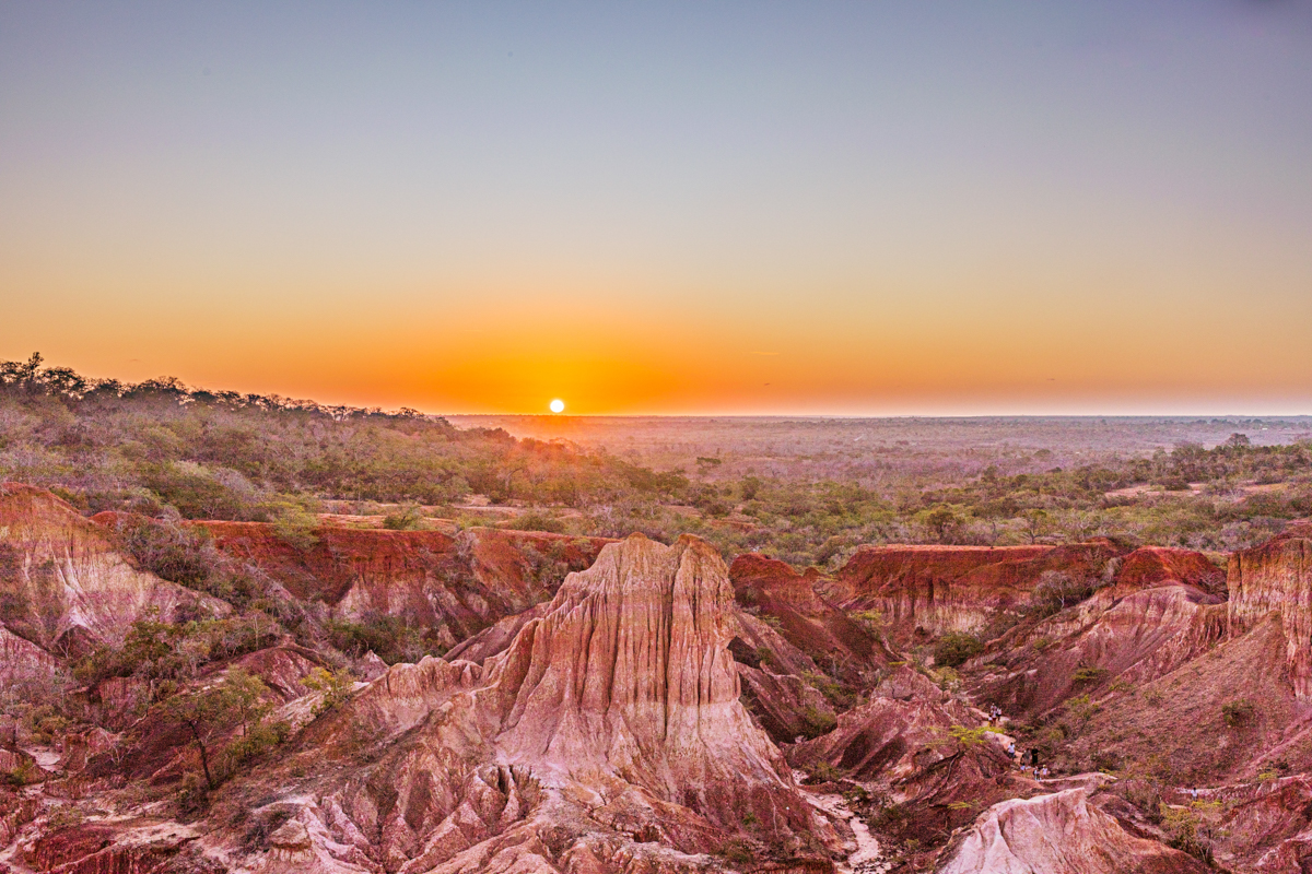
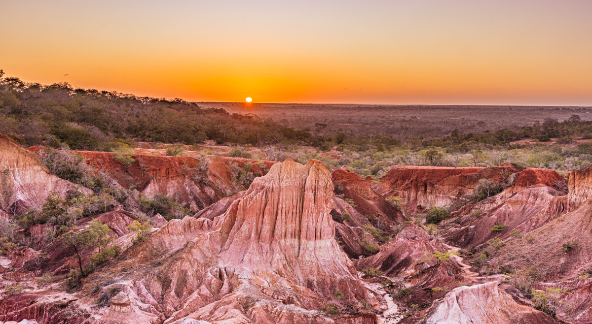
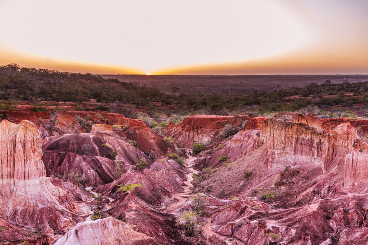
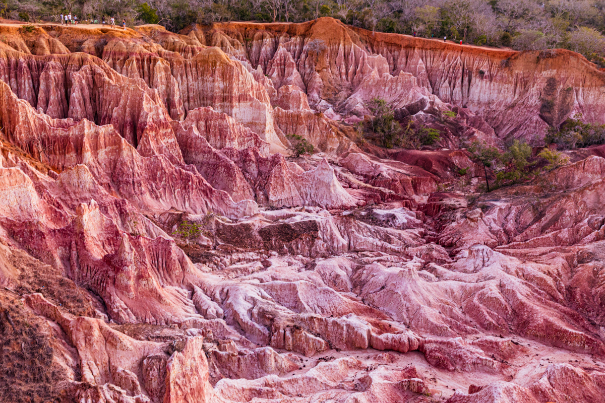
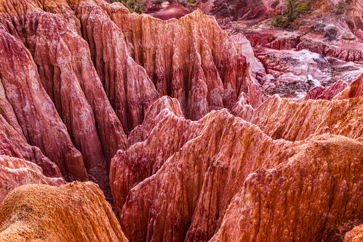
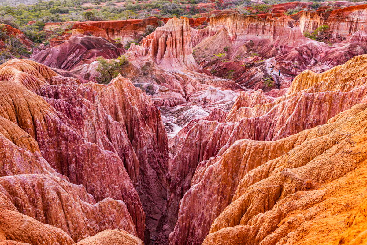
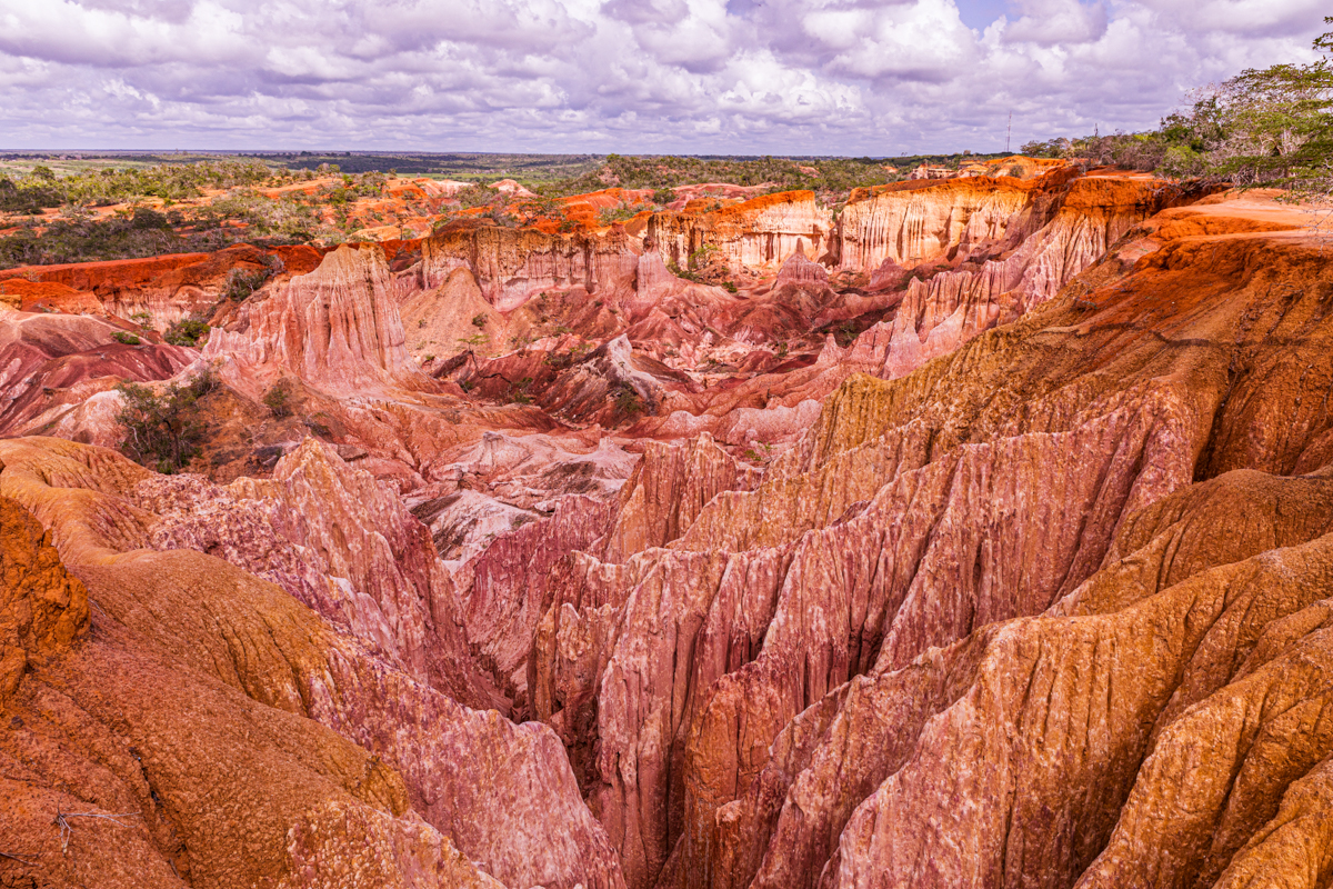
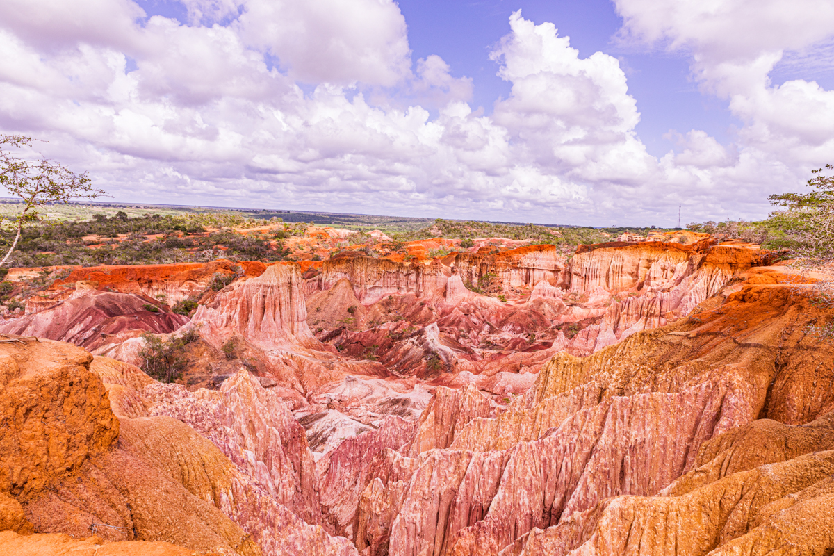
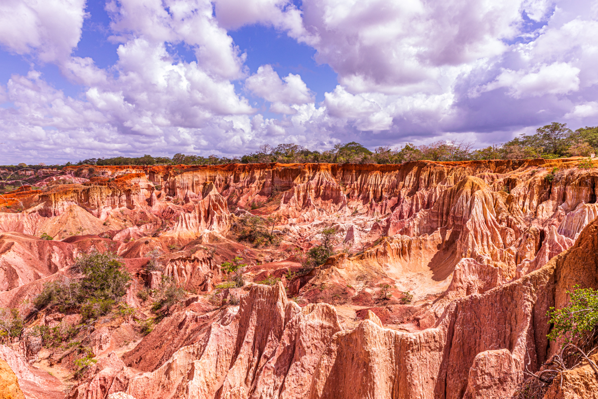
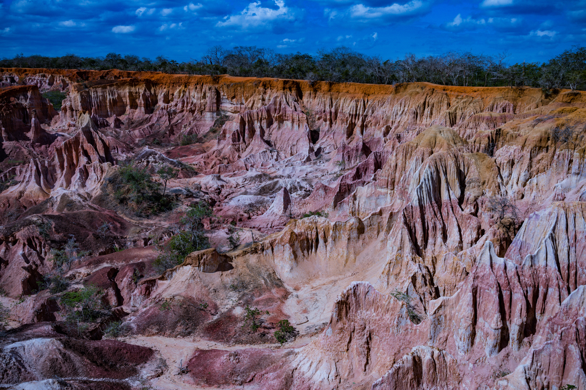
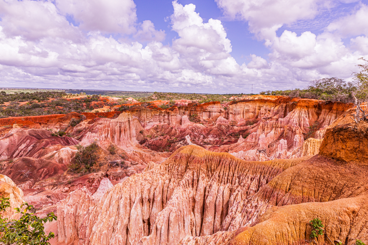
Its exposed formations display contrasting shades of red, orange, yellow, pink, cream and white. Deep channels cut through the landscape, while isolated rock pillars and steep-sided gullies create a complex terrain that changes in appearance as sunlight moves across it.
The name Hell’s Kitchen is commonly associated with the intense heat experienced inside the depression during the hottest periods of the day. The dramatic appearance of the landscape, combined with the local legends surrounding its formation, has helped make it a distinctive attraction for visitors travelling along Kenya’s northern coast.
But Marafa is more than an unusual geological formation.
It is part of the cultural and geographical landscape of the Giriama people, a community whose traditions, oral histories and relationship with the surrounding environment contribute to the identity of the attraction.
The site is also an example of community-based tourism in rural Kilifi County. Local residents participate in guiding, visitor management and conservation, with tourism providing an avenue for community development.
For a first-time visitor, understanding Marafa requires looking beyond its photographs. Its geographical location, geological origins, cultural significance, accessibility, walking conditions and conservation challenges are all important parts of the experience.
This comprehensive guide explores these subjects in detail, providing practical information for visitors while documenting the natural and cultural heritage of Marafa Hell’s Kitchen.
1. Where is Marafa Hell’s Kitchen?
Marafa Hell’s Kitchen is located near Marafa village in Magarini Sub-County, Kilifi County, in Kenya’s coastal region.
It lies inland from Malindi, approximately 30–40 kilometres away, depending on the starting point and route.
Malindi is the most convenient established tourism centre from which to organise a visit. The town has accommodation, restaurants, transport services and other visitor facilities that are not as readily available in the smaller settlements surrounding Marafa.
The attraction is reached by road from Malindi, travelling inland through rural coastal settlements and countryside.
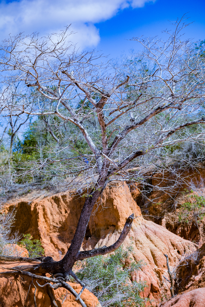
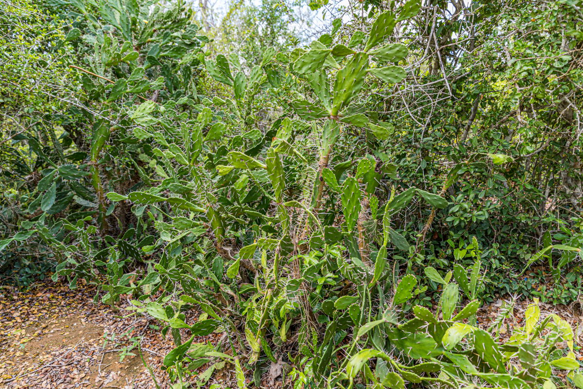
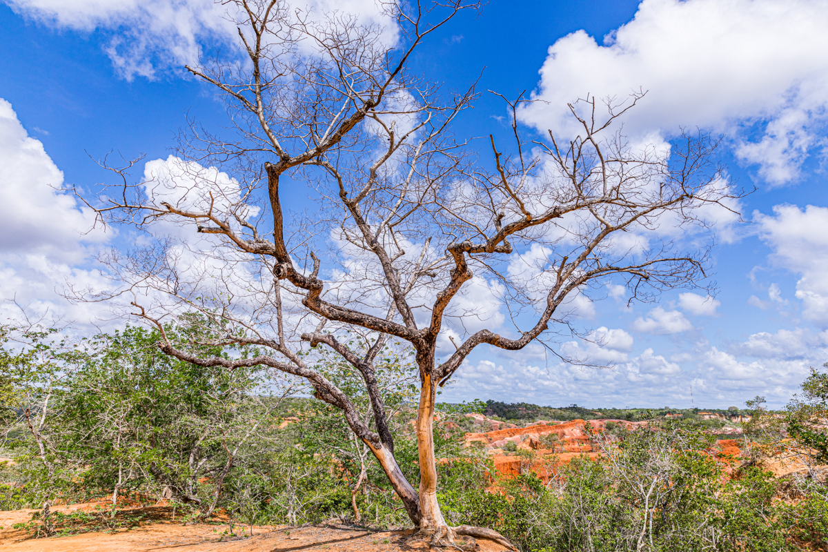
The surrounding landscape is different from the developed beach areas. Visitors may encounter scattered baobab trees, agricultural plots, rural homesteads, trading centres and stretches of vegetation adapted to the relatively dry coastal hinterland.
The attraction is situated within a wider landscape associated with the Sabaki River drainage system and the sedimentary formations of the Magarini area.
Its location also places it within a region of considerable environmental and cultural importance, including the wider Dakatcha landscape.
Marafa’s geographical setting
The wider Magarini area contains a combination of coastal plains, uplands, minor valleys and erosional features.
The regional geological environment includes sedimentary rocks, coastal deposits, sandstones and other formations.
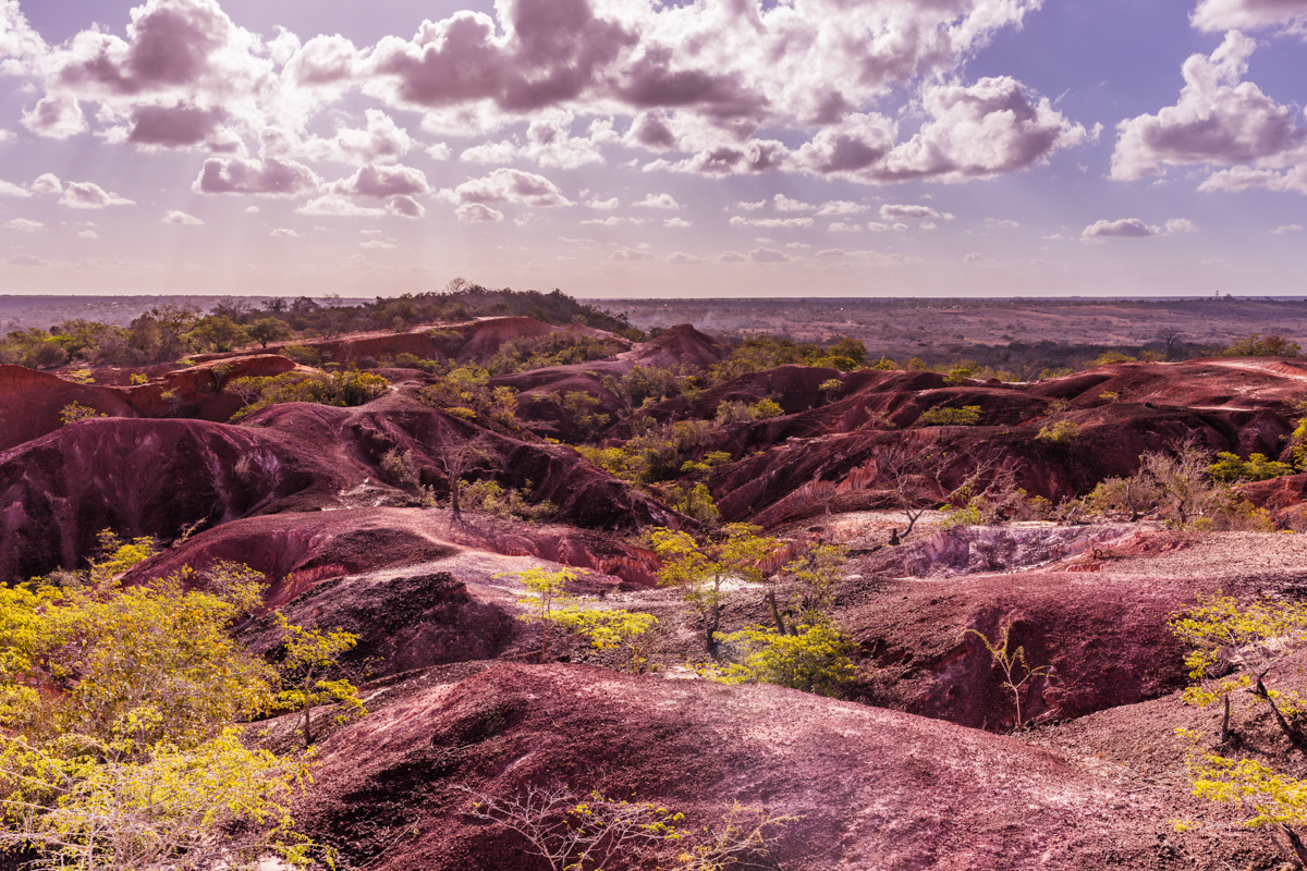
Marafa’s most distinctive feature is the exposed erosional landscape north of the village.
This geographical distinction matters because the attraction is not an isolated rock formation sitting in an otherwise unrelated environment. It is part of a larger geological and ecological setting.
Marafa village and its surroundings
Marafa village is an important part of the visitor experience. The attraction should not be treated as though it exists independently of the settlement surrounding it.
The journey from Malindi passes through a rural landscape where visitors can observe different aspects of everyday life in the coastal hinterland.
Depending on the route, visitors may encounter:
- Baobab trees and scattered indigenous vegetation.
- Rural homesteads.
- Small agricultural plots.
- Local trading centres.
- Livestock and agricultural activities.
- Community facilities and village roads.
These surroundings provide an opportunity to appreciate a different geographical and social environment from the established coastal tourism centres.
Is Marafa Hell’s Kitchen the same as Hell’s Gate?
No.
This is an important distinction for international visitors and people planning a Kenya itinerary.
- Marafa Hell’s Kitchen: Located near Malindi in Kilifi County, on the Kenyan coast.
- Hell’s Gate National Park: Located near Naivasha in Nakuru County, within the Great Rift Valley.
They are different destinations, with different geographical settings, geological characteristics and visitor experiences.
A visitor searching for Hell’s Kitchen in Malindi should not accidentally plan a journey to Hell’s Gate in Naivasha.
2. Understanding the Marafa Depression and its geological formation
The most striking characteristic of Marafa Hell’s Kitchen is its unusual terrain.
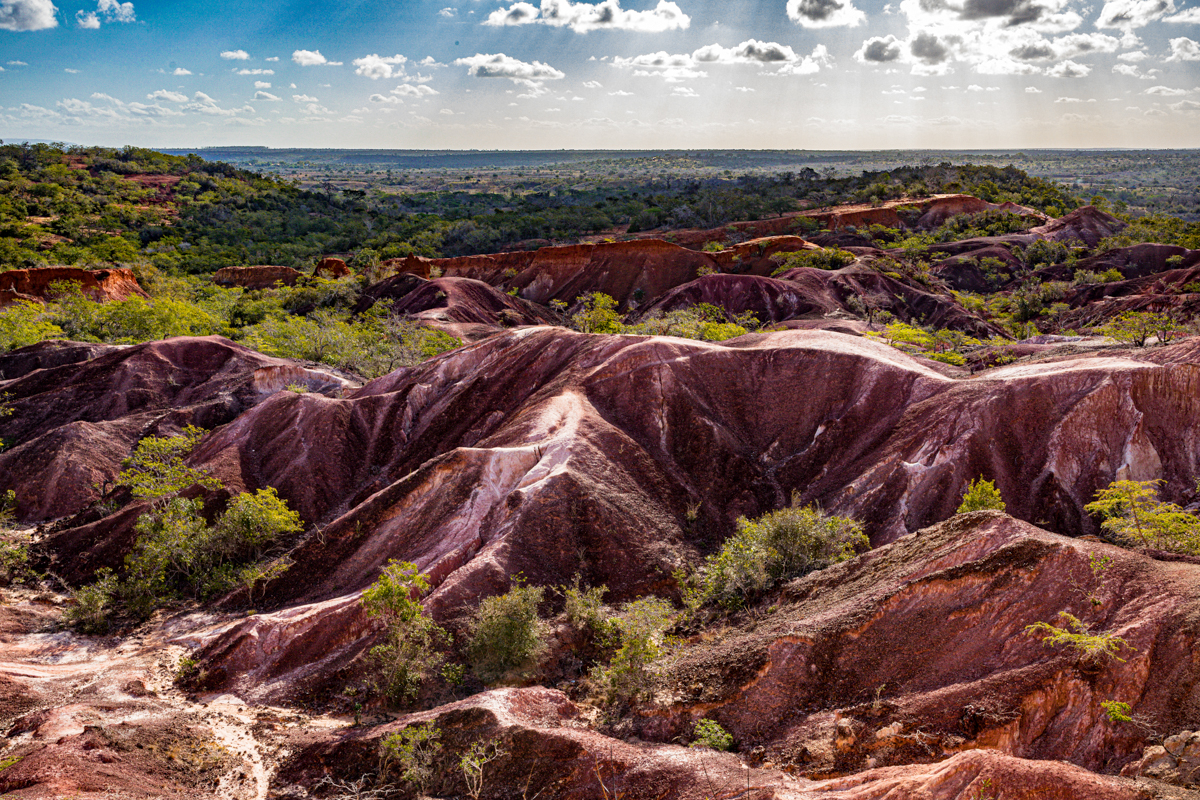
The attraction consists of a series of eroded gullies, exposed ridges, sandstone walls, isolated pillars and irregular rock formations. The landscape is sometimes described as a canyon, gorge, depression or crater. Although these descriptions help visitors imagine its appearance, they do not all mean the same thing geologically.
The more useful geographical description is an erosional landscape associated with the Marafa geological formations and an exposed erosional scarp.
What created Hell’s Kitchen?
The geology of the wider Magarini region is particularly interesting.
An environmental assessment prepared for the area identifies unconsolidated to slightly consolidated geological materials of Tertiary and Quaternary origin.
The older Fundi Isa limestone formation is identified as Miocene in age and includes yellow limestone, fine-grained calcareous sandstone, marl and sands.
The assessment also identifies the Marafa beds, now commonly referred to as the Marafa formations, as being well exposed along an erosional scarp known as Hell’s Kitchen, north of Marafa village.
This is a significant distinction. Rather than relying on the general description of a sandstone canyon, visitors can understand that Marafa forms part of a recognised local geological sequence.
The visible landscape has been shaped by the gradual removal and breakdown of relatively weak geological materials.
Several natural processes contribute to this transformation.
Water erosion: Rainwater runs over exposed ground, carrying loose sediment and progressively cutting channels into softer materials.
Weathering: Changes in moisture, temperature and exposure weaken the surfaces of exposed geological formations.
Wind erosion: Wind transports loose particles, which can contribute to the wearing away of exposed surfaces.
Differential erosion: Geological layers do not necessarily erode at the same rate. More resistant materials can remain standing while softer surrounding materials are removed.
Together, these processes produce the ridges, gullies, exposed walls and isolated formations that distinguish Marafa.
Understanding the Marafa formations and Magarini sands
An important geological distinction is often overlooked in descriptions of Hell’s Kitchen.
The Marafa formations and the Magarini sands are identified as separate geological units in regional geological descriptions.
The Magarini sands are described as well-sorted sands with quartz grains carrying thin ferric oxide coatings. These materials are relevant to understanding the broader regional geology and the red colours found in parts of the coastal hinterland.
However, the entire visible depression should not simply be labelled Magarini sands.
The Marafa formations have their own geological identity and are specifically associated with the erosional scarp.
This distinction is important for an educational travel article because the geological terminology should reflect the actual formations rather than rely on general descriptions of coloured sand and sandstone.
What does the landscape look like?
The landscape is characterised by:
- Deeply eroded channels.
- Steep-sided gullies.
- Exposed sandstone walls.
- Irregular rock ridges.
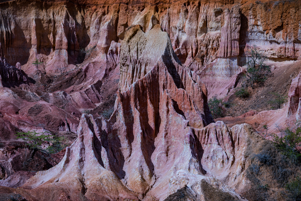
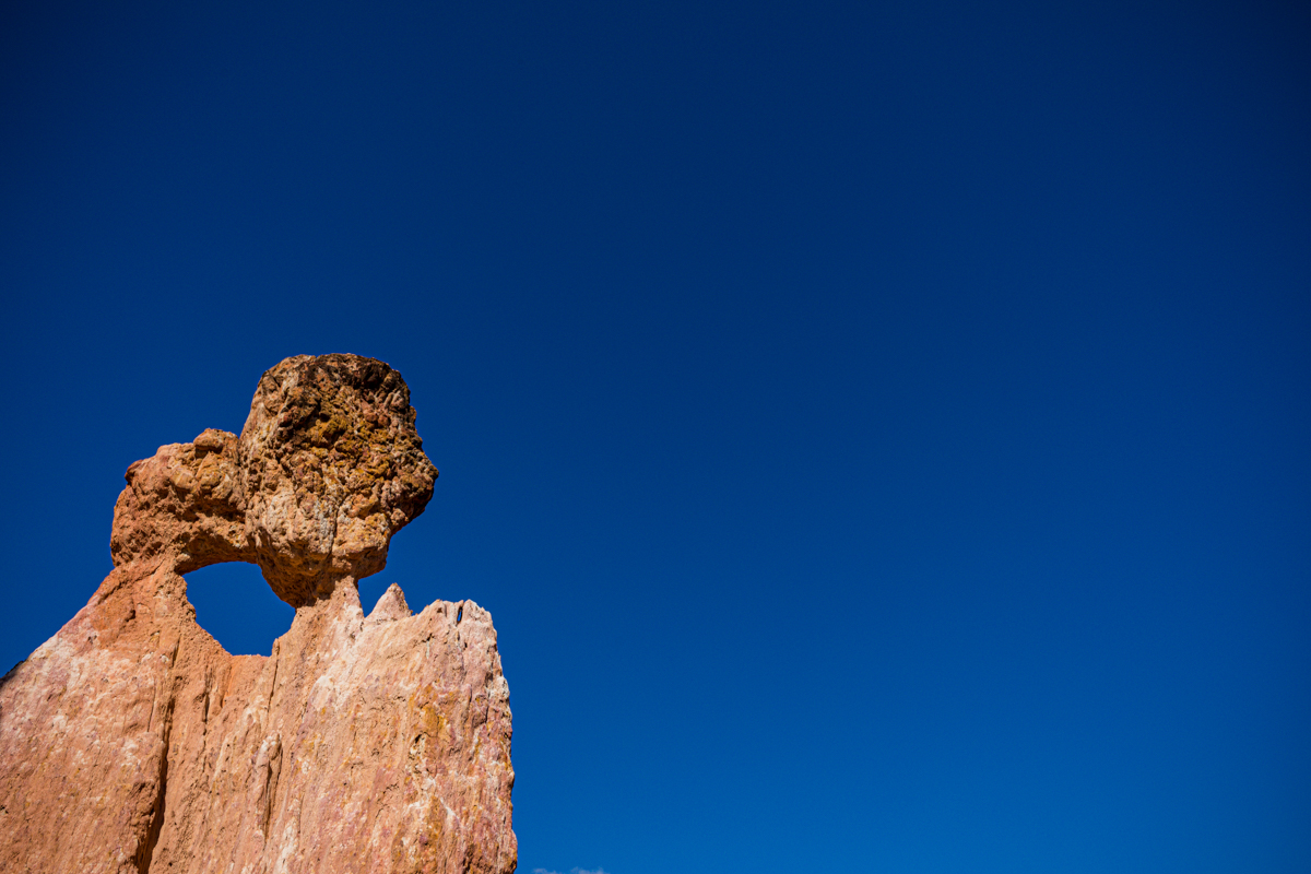
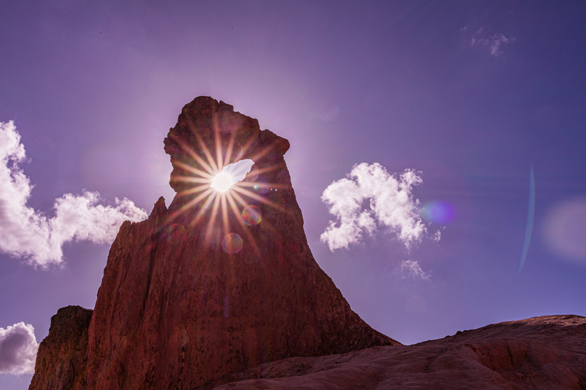
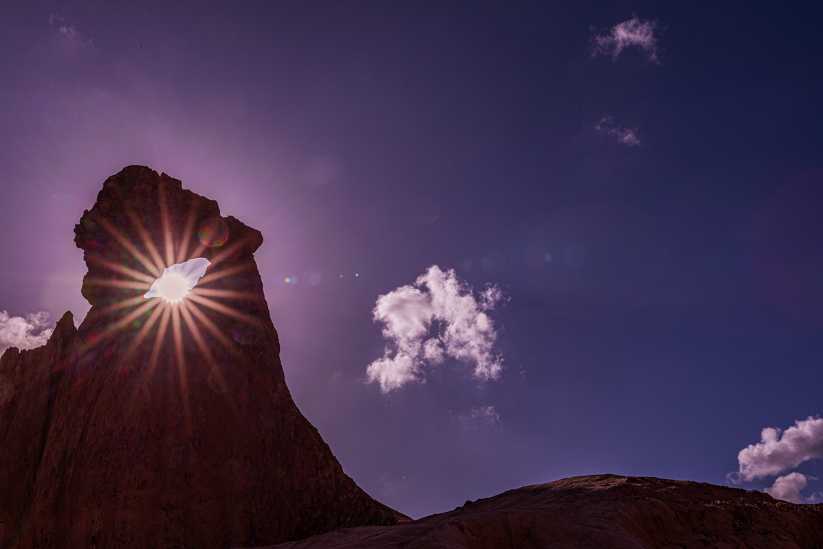
- Chimney-like pillars.
- Isolated rock formations.
- Natural passages between eroded surfaces.
- Contrasting geological colours.
The individual formations vary in size and shape, creating an irregular landscape that is visually different from conventional coastal scenery.
Is Hell’s Kitchen a volcanic crater?
No evidence in the geological information reviewed supports describing Marafa as a volcanic crater.
Its appearance can resemble a collapsed or sunken landscape, but visual resemblance is not geological proof.
The geological documentation identifies the Marafa formations in relation to sedimentary materials and erosion.
For this reason, Antony Trivet Photography consistently describes the attraction as an erosional depression or sandstone landscape rather than a volcanic crater.
How tall are the rock formations?
Published accounts describe some of the chimney-like formations as rising to approximately 30 metres.
This is a reported descriptive measurement, not a complete survey of every formation at the attraction.
The height of individual rock structures must also be distinguished from the total depth of the depression.
How deep is Marafa Hell’s Kitchen?
There is no sufficiently reliable, independently verified measurement available to establish the maximum depth of the entire depression.
Some travel websites give impressive dimensions, but do not identify the survey, measuring method or geological authority behind those figures.
This guide therefore does not assign an unsupported depth or total width.
The attraction is extensive enough to contain multiple gullies, ridges and viewpoints, and its boundaries and walking routes should be understood through the local management arrangements.
Is the landscape still changing?
Yes.
Erosion is an ongoing natural process, and Marafa’s exposed terrain continues to change.
Published reporting has documented how erosion has forced the community to relocate viewpoints and access routes several times because of changing ground conditions.
The practical implication for visitors is straightforward: the route shown in an older photograph, video or travel article may not be the current route.
Always follow the designated access points and instructions of the local guides.
3. The colours of Marafa: Red, orange, yellow, pink and white sandstone
One of the reasons Marafa has attracted photographers and travellers is its unusual range of geological colours.
The exposed landscape contains striking variations in:
- Red and deep crimson.
- Burnt orange.
- Yellow and ochre.
- Pink and pale rose.
- Cream and white.
- Light grey.
The contrast between these colours creates the impression of a naturally sculpted landscape.
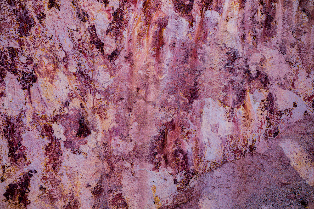
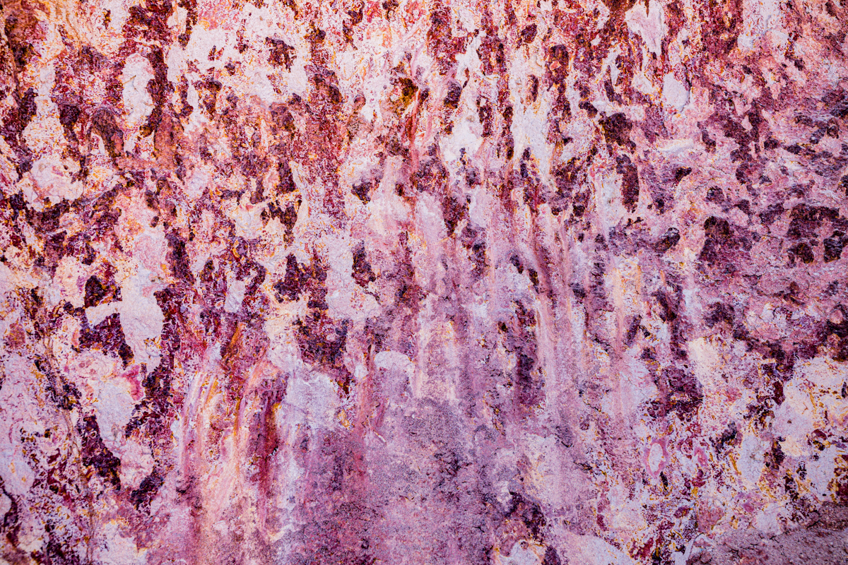
The variations are associated with differences in the composition, weathering and oxidation of the geological materials.
Iron-bearing compounds, particularly iron oxides, can contribute to reddish and orange colours in sedimentary deposits. Regional geological descriptions also identify ferric oxide coatings on quartz grains in the Magarini sands.
However, the Magarini sands and the exposed Marafa formations should not automatically be treated as identical geological units.
The colour of every formation at Hell’s Kitchen has not been established through the mineralogical analysis available for this article.
It is therefore more accurate to explain the colour variations through differences in geological composition and weathering rather than claiming that every white, yellow or red section has a specific, proven mineral explanation.
Why does the landscape look different at sunset?
The appearance of Marafa changes considerably with the direction and intensity of sunlight.
During the middle of the day, direct sunlight can create strong contrasts and harsh shadows.
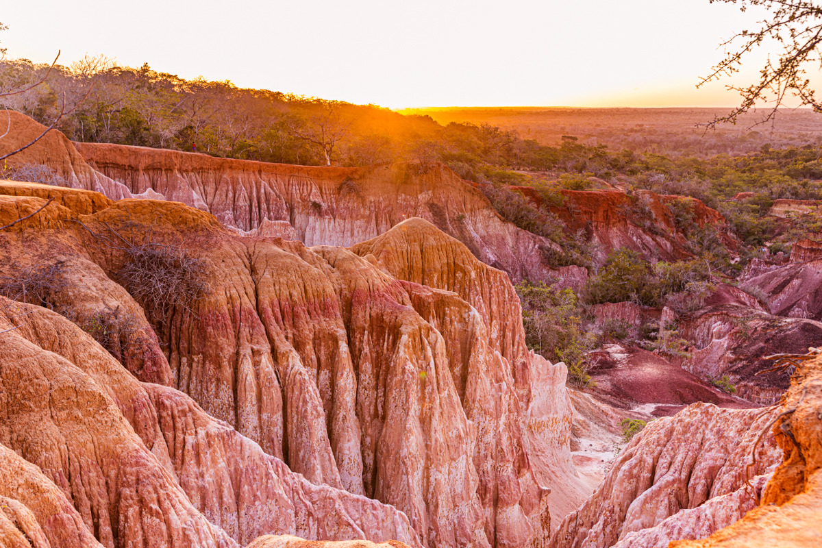
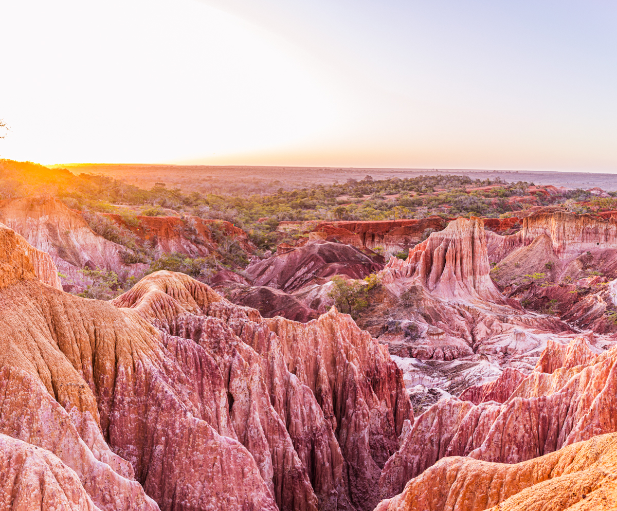
Towards late afternoon, the lower angle of sunlight illuminates the exposed rock surfaces differently. The warm light enhances the appearance of red, orange and golden tones, while the shadows reveal the depth of the gullies and the irregular surfaces of the formations.
This is one of the reasons sunset has become a popular part of the Marafa visitor experience.
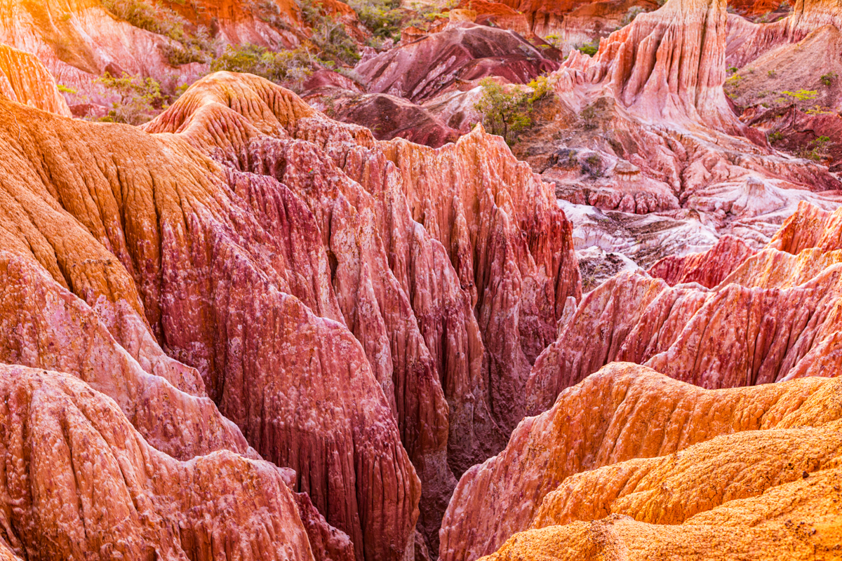
For photographers, the changing light provides opportunities to document the landscape in different ways, from wide views of the depression to close studies of its geological textures.
What makes the colours particularly interesting?
The attraction is not defined by one uniform colour.
Different surfaces respond differently to sunlight. Some areas appear pale and reflective, while others display deep red or orange tones.
The contrast between light-coloured rock and darker eroded channels gives the landscape much of its visual character.
For visitors, this is one of the most memorable aspects of the attraction.
For photographers, it creates an opportunity to study how natural light interacts with geological surfaces.
4. Why is it called Hell’s Kitchen?
The name Hell’s Kitchen is generally associated with the intense heat experienced inside the depression.
The exposed rock surfaces receive direct sunlight, while sections of the lower landscape offer limited shade.
Published reports and the Kenya Film Commission’s location information have referred to daytime temperatures reaching approximately 50°C in some sections of the canyon.
These are reported conditions, not a continuous temperature record or a guarantee that every visitor will experience 50°C.
Nevertheless, they explain why the attraction has developed a reputation for extreme heat.
The name is not an indication of volcanic activity, underground fire or geothermal activity.
It is a popular descriptive name associated with the environmental conditions of the depression.
Why visitors should avoid the hottest hours
The temperature is not simply a matter of comfort.
Walking through a steep, exposed landscape in intense heat can increase the risk of dehydration, exhaustion and heat-related illness.
Visitors should plan their descent for a cooler period, carry sufficient water and follow local guidance.
A late afternoon visit is particularly useful because it combines more manageable temperatures with favourable photographic conditions.
Is the temperature always 50°C?
No.
The reported figure should not be interpreted as the permanent temperature of the attraction.
Actual conditions depend on weather, time of day, season, direct sunlight and the particular section of the depression.
Visitors should prepare for hot conditions without assuming that a published extreme temperature is an accurate forecast for their visit.
5. Nyari: The Giriama name and the cultural identity of Marafa
The attraction is locally known as Nyari.
The name appears in different publications with varying English interpretations.
Some sources translate it as the natural sacred depression, while others use the place broken by itself or the place crumbling naturally by itself.
The differences should not be ignored.
Kigiriama is a language with its own linguistic and cultural context. A translation repeated in English-language tourism material is not necessarily a complete explanation of the original word.
For the purposes of this article, Nyari is best presented as the local name associated with the depression, with the differing interpretations clearly acknowledged.
The Giriama people
The Giriama are one of the Mijikenda communities of Kenya’s coast.
Their history, cultural traditions, social organisation and relationship with the coastal environment form an important part of the heritage of Kilifi County.
The cultural identity of the region is not limited to the Giriama. Other communities, including the Wata, have historical connections to the wider coastal hinterland.
Marafa should therefore be understood within a broader history of settlement, movement, land use and cultural interaction.
Nyari as a place of traditional significance
Local accounts associate the depression with traditional spiritual practices and the collection of medicinal plants.
These accounts suggest that Nyari had significance beyond its physical appearance and that the surrounding environment was understood through traditional knowledge systems.
The attraction has also been described in cultural accounts as a place associated with traditional rituals and spiritual practices.
However, not every claim about the exact nature, frequency or location of traditional rituals has been independently documented.
It is important to distinguish what community elders and guides remember from what can be established through historical records.
For Antony Trivet Photography, the strongest approach is to record these traditions through properly attributed interviews rather than turn them into unqualified historical statements.
The meaning of sacred landscapes
The cultural significance of a landscape does not always depend on the presence of a building, monument or formally designated religious site.
For many communities, natural features, forests, particular trees, hills, water sources and geological formations can hold spiritual and historical significance.
The traditions associated with Nyari should be understood within this wider relationship between people and their environment.
Visitors should therefore allow local guides and community representatives to explain the traditions they are comfortable sharing.
6. The legends of Marafa Hell’s Kitchen
The unusual appearance of Marafa has inspired stories that explain how the depression came into existence.
These stories are important to the attraction because they provide insight into local beliefs, values and cultural memory.
They should be understood as oral traditions, not as geological explanations.
The wealthy family and the story of milk and blood
One of the most widely repeated legends concerns a wealthy family that once lived in the area.
According to the story, the family possessed considerable wealth and livestock but became excessively extravagant.
The family is said to have used milk from its cows for bathing, even as other members of the surrounding community struggled with poverty.
The behaviour was interpreted as an expression of arrogance, vanity and a lack of appreciation for the family’s blessings.
According to the legend, the heavens became displeased with this extravagance and the ground opened, swallowing the settlement and its inhabitants.
The resulting depression became the landscape known today as Hell’s Kitchen.
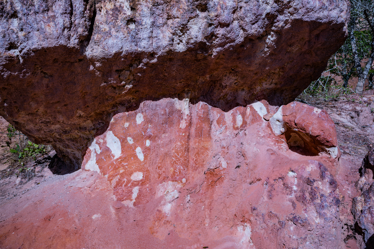
In the traditional explanation, the white rock formations represent the wasted milk, while the red formations represent blood.
The story is a moral narrative about excess, inequality, gratitude and the consequences of arrogance.
It is not an established account of the geological formation.
The story of the vanished settlement and the elderly woman
Another version of the oral tradition describes a settlement whose residents were warned to leave before a catastrophic event.
In some accounts, most residents escaped, while an elderly woman remained behind.
The settlement subsequently disappeared, leaving the depression.
The details vary between tellings, and the story should be recorded as an oral tradition rather than a verified historical event.
The Wakiza family and the historical question
The original Antony Trivet Photography account refers to the Wakiza clan and a wealthy family said to have occupied the area.
This is worth investigating further.
Historical research on Giriama social organisation identifies Mukiza among traditional clan names in Giriama oral history.
However, the existence of a historical Giriama clan called Mukiza does not, by itself, prove the specific Wakiza family story or establish that this family occupied the exact site of Hell’s Kitchen.
The spelling difference between Mukiza and Wakiza should not be silently corrected or treated as evidence that the two accounts refer to the same people.
A local elder or historian should be asked to explain the name and its connection to the legend.
Until that verification is obtained, the Wakiza account should remain attributed local oral history.
Why the legends should remain part of the visitor experience
The geological explanation and the oral traditions serve different purposes.
Geology explains the physical formation of the landscape.
Folklore explains how people have interpreted the landscape and incorporated it into their cultural memory.
One does not need to displace the other.
A visitor can understand the erosional processes that created the depression while also appreciating the traditional stories associated with Nyari.
That distinction is central to responsible cultural tourism.
7. The Marafa community: Ownership, tourism and conservation
Marafa Hell’s Kitchen is a community-associated attraction, and local participation is central to its visitor management.
The community has an important role in guiding visitors, organising access, interpreting the landscape and maintaining the tourism experience.
The attraction also demonstrates how natural heritage can support economic activity in a rural area.
Marafa Hell’s Kitchen Tour Operators
The Marafa Hell’s Kitchen Tour Operators organisation, commonly abbreviated as MHKTO, is identified in recent reporting as the community-based organisation involved in managing the attraction.
A March 2026 report describes the organisation’s role in working with community members and government agencies to protect the site.
The report identifies several developments:
- Establishment of conservation committees.
- Demarcation of the attraction’s boundaries.
- Collaboration with county and national government agencies.
- Efforts to address land encroachment.
- Support for local guiding and tourism development.
- Community investment in education and infrastructure.
The report attributes these details to community representatives and government officials.
It also gives the attraction an estimated area of approximately 210 acres.
This figure should be treated as the reported management-area figure, not as a confirmed measurement of the visible canyon floor or the entire geological depression.
Understanding the reported 210 acres
The reported 210-acre figure is important because it gives an indication of the wider area being managed and protected.
However, visitors should not assume that the entire area is accessible for tourism or that all 210 acres consist of exposed sandstone formations.
A management boundary can include the attraction and surrounding land necessary for conservation, access and community management.
The precise relationship between the demarcated land, the geological depression and any legally registered property boundaries should be established through the relevant land records.
This distinction matters because the attraction’s physical geological extent and its community-managed land area are not necessarily the same thing.
How tourism supports the community
Tourism provides an opportunity for local people to participate in the visitor economy.
Potential sources of livelihood include guiding, visitor assistance, local services and other tourism-related activities.
Earlier reporting documented the use of tourism income for education-related community support, including bursaries.
More recent reporting describes investment in school facilities and local infrastructure.
This makes Marafa an important example of the relationship between tourism and community development.
However, responsible reporting should not suggest that all community members receive equal financial benefits or that all tourism revenue is distributed through the same arrangements.
The correct approach is to explain the documented initiatives and allow the management organisation to provide further details about its current financial and community-benefit structure.
Why visitors should use local guides
Hiring a local guide is strongly recommended.
A guide can help visitors understand the landscape, identify the appropriate walking routes and learn about local traditions.
More importantly, guides provide information that cannot always be obtained from a written travel article.
They know which viewpoints are accessible, which areas have become unstable and which parts of the attraction should be avoided.
Visitors also contribute to the local tourism economy by using community-managed services.
Tourism and local education
One of the most meaningful aspects of community-based tourism is the potential to connect visitor spending with local opportunities.
Education-related bursaries and improvements to community facilities have been mentioned in accounts of the Marafa tourism initiative.
Such initiatives demonstrate why community participation is important.
However, visitors who want to understand exactly how tourism revenue is used should request current information from the management organisation.
Transparency about community benefits is an important part of sustainable tourism.
8. Marafa and the wider environmental landscape
The attraction should not be considered independently of its surrounding environment.
Marafa lies within a wider coastal hinterland characterised by sedimentary formations, dryland vegetation, agricultural landscapes and areas of ecological importance.
One of the notable regional environmental features is the Dakatcha Woodland landscape.
Dakatcha Woodland
The Dakatcha Woodland is an important area of coastal dry forest and woodland in Kilifi County.
It is recognised for its biodiversity and conservation significance.
The wider landscape supports plant and animal life adapted to the coastal dryland environment and has been the subject of biodiversity and conservation research.
Its ecological value is relevant to the Marafa story because the attraction exists within a larger environment where land use, vegetation, water availability and conservation are important issues.
However, visitors should not assume that the woodland is part of the Hell’s Kitchen attraction or that it can be explored through the same visitor arrangements.
A separate visit requires its own planning, access permissions and consideration of local conservation requirements.
Why the wider landscape matters
The coastal hinterland is an interconnected environment.
Vegetation helps protect soil, supports wildlife and contributes to the stability of the wider landscape.
Changes in land use, deforestation, agricultural expansion and other human activities can influence environmental conditions.
In dryland environments, woodland conservation is particularly important because vegetation contributes to soil protection and the retention of ecological functions.
The relationship between Marafa and the surrounding environment is therefore relevant to understanding the attraction beyond its appearance.
Why erosion is both an attraction and a concern
The erosion that gives Marafa its extraordinary appearance also presents a conservation challenge.
The removal of sediment and the collapse of exposed surfaces continually modify the terrain.
Earlier reporting documented the relocation of viewpoints and access routes because of this changing landscape.
More recent reporting on community conservation initiatives also highlights concerns about environmental degradation and land encroachment.
These are related but distinct issues:
- Natural erosion changes the physical landscape.
- Human encroachment can affect the integrity of the attraction and surrounding land.
- Poorly managed tourism can contribute to additional environmental pressure.
A sustainable visitor experience must account for all three.
Is Hell’s Kitchen gazetted?
This is a claim that requires particular care.
The original Antony Trivet Photography article describes the attraction as gazetted.
However, the research reviewed for this updated guide has not established a specific Kenya Gazette notice, legal designation or protected-area instrument confirming the precise status of the Hell’s Kitchen site.
Recent reporting describes community boundary demarcation and government collaboration. That is not, by itself, proof of formal gazettement.
Until the relevant Gazette notice or legal documentation is obtained, the article should describe Marafa as a community-managed attraction undergoing conservation and boundary-management initiatives.
It should not state that the attraction is gazetted as a protected area without evidence.
Community conservation and the future of Marafa
The recent conservation initiatives represent an important development in the story of Hell’s Kitchen.
Boundary demarcation, local conservation committees and cooperation with government agencies provide a framework for protecting the attraction against encroachment and uncontrolled land use.
The effectiveness of these measures will depend on their continued implementation, local participation, appropriate enforcement and adequate resources.
For visitors, the message is simple: the attraction should be treated as a natural and community heritage site whose long-term future depends on responsible management.
9. How to get to Marafa Hell’s Kitchen
For most visitors, Malindi is the most convenient starting point for a trip to Marafa.
The journey takes visitors away from the developed coastal tourism areas and into the rural interior of Kilifi County.
Travelling from Malindi
Marafa is approximately 30–40 kilometres from Malindi, depending on the route and starting point.
The Kenya Film Commission’s filming locations information describes the journey as approximately half an hour from Malindi, with most of the road tarmacked apart from the final approach towards Marafa village.
For a visitor, I would allow approximately 45 minutes to one hour rather than plan around the shortest published journey time.
This gives room for traffic, navigation, road conditions and the final approach.
The journey is an opportunity to observe the rural landscape surrounding Malindi, including settlements, agricultural land and scattered baobab trees.
Travelling from Watamu
Visitors staying in Watamu can travel towards Malindi before continuing inland to Marafa.
The journey is straightforward to organise with a private driver or a pre-arranged excursion.
Allow additional time for the journey, particularly if you intend to return to Watamu after sunset.
Travelling from Mombasa
Visitors travelling from Mombasa should first travel north towards Malindi and then continue inland.
This is a longer excursion and is best planned as part of a wider coastal itinerary.
If you are travelling from Mombasa specifically to visit Hell’s Kitchen, an early departure is advisable.
Travelling by private vehicle
A private vehicle offers the greatest flexibility.
It allows visitors to choose their departure time, carry sufficient drinking water and arrange a return journey that accommodates the sunset experience.
A vehicle with reasonable ground clearance may be useful on the final approach, particularly after rainfall.
The entire route should not automatically be described as suitable for a four-wheel-drive vehicle in every season. Current road conditions should be confirmed locally.
Travelling by taxi
Visitors can arrange a taxi from Malindi.
However, confirm whether the quoted fare includes:
- The journey to Marafa.
- Waiting time during the visit.
- The return journey.
- Any additional charges for an evening return.
Do not assume that a taxi will be readily available for the return journey if the visit extends into the evening.
Travelling by public transport
Public transport is possible, but it requires more planning.
Travel guides describe morning matatu connections from Malindi towards Marafa village, followed by a walk to the attraction.
Published fares and journey times should be treated as historical reference information rather than current prices.
Before relying on public transport, confirm:
- Where to board in Malindi.
- Whether vehicles operate on the day of travel.
- Where to alight.
- How to reach the attraction from the village.
- Whether transport is available for the return journey.
- Whether the service operates late enough for a sunset visit.
For international visitors unfamiliar with the area, pre-arranged transport is generally the more convenient option.
Navigation and local directions
Visitors should not rely exclusively on an online map pin without confirming the final approach.
The entrance, parking arrangements and walking access may be affected by changes to the site and surrounding roads.
Once in Marafa, ask for directions to the community-managed Hell’s Kitchen entrance.
For first-time visitors, this is preferable to attempting to locate an unofficial access route.
10. When is the best time to visit Marafa Hell’s Kitchen?
The most rewarding times to visit are generally early morning and late afternoon.
The choice depends on whether the visitor prioritises cooler walking conditions, photography or the sunset experience.
Early morning visits
Morning visits have several advantages.
Temperatures are generally more comfortable, and the softer light can reveal the texture of the exposed rock formations.
This is a good option for visitors who prefer walking before the heat builds up.
It can also be suitable for photographers interested in documenting the landscape without the strong contrast associated with midday sunlight.
Late afternoon visits
Late afternoon is particularly popular.
As the sun descends, the exposed rock formations receive warmer light, and the shadows become more pronounced.
The changing illumination reveals the different shapes and textures of the landscape.
Visitors can observe how the colours of the depression change as the sun approaches the horizon.
Sunset at Marafa
Sunset is one of the most visually appealing aspects of a Marafa visit.
The exposed formations create an interesting contrast between illuminated rock surfaces and darker gullies.
For photographers, this offers opportunities to capture:
- Wide views of the depression.
- Silhouettes of the rock formations.
- Warm light across exposed sandstone.
- Shadows extending across the gullies.
- The surrounding landscape as daylight fades.
Visitors should arrive sufficiently early to explore the attraction before sunset.
It is not advisable to begin a strenuous descent when daylight is disappearing.
Sunset viewing should also be arranged with the local management. Visitors should not assume that all sections remain accessible until any particular time.
Which months are best?
It is difficult to identify one universally perfect month for visiting Marafa because the experience depends on rainfall, road conditions, temperature and access arrangements.
Kenya’s coastal region experiences seasonal rainfall, and the conditions of the exposed gullies can change after heavy rain.
For practical planning:
- Consider the drier periods if you want more predictable walking conditions.
- Check local rainfall and road conditions before travelling during the wet seasons.
- Avoid assuming that the site will be accessible simply because a previous visitor travelled there during the same month.
The most important factor is not the calendar month alone, but the actual conditions at the attraction on the day of your visit.
11. How much time should you spend at Marafa?
For a first-time visitor, allow approximately two to three hours at the attraction.
This is a planning recommendation, not an official tour duration.
The time can be divided between:
| Activity | Suggested time |
|---|---|
| Arrival and visitor arrangements | 15–30 minutes |
| Introduction and local guiding | 15–20 minutes |
| Exploring the viewpoints and walking routes | 45–75 minutes |
| Photography and observation | 30–45 minutes |
| Returning and concluding the visit | 15–30 minutes |
Actual timings depend on the route available, the visitor’s fitness, the weather and the extent of the exploration.
Visitors who want to photograph the landscape in detail may need longer.
The Kenya Film Commission’s location handbook describes a route to the base of the canyon involving approximately 20 minutes of hiking. This should be treated as a historical route description, not a guarantee of the current descent time.
Because erosion continually changes the terrain, the current route should always take priority over older descriptions.
Is the descent difficult?
The difficulty depends on the route available and the condition of the terrain.
Some sections may involve loose material, steep slopes, uneven surfaces and narrow passages.
Visitors should not assume that the descent is a straightforward walk suitable for everyone.
Before descending, ask the local guide about:
- The current route.
- The approximate walking duration.
- The steepest sections.
- The condition of the ground.
- Whether the return climb is suitable for your fitness level.
- Whether alternative viewpoints are available.
Should you visit just for sunset?
A sunset visit can be rewarding, but it should not be reduced to arriving at the last moment to take photographs.
Allow sufficient time to understand the landscape and explore the accessible viewpoints.
A well-planned visit provides a much better experience than a rushed arrival immediately before sunset.
12. Entrance fees, opening hours and local visitor arrangements
Marafa Hell’s Kitchen is managed as a community tourism attraction.
Visitors should expect to make arrangements through the local management and follow the applicable entry and guiding procedures.
What is the entrance fee?
There are different entrance-fee figures published online.
Some websites provide older prices, while others display figures without identifying when they were last updated or which visitor categories they cover.
A current, independently confirmed official tariff has not been established for this guide.
For this reason, I would not publish KSh 500, KSh 700, KSh 1,000 or any other figure as the definitive current entrance fee.
Instead, visitors should confirm the latest charges directly with the Marafa Hell’s Kitchen Tour Operators organisation before travelling.
Ask whether the quoted amount includes guiding or whether guiding is charged separately.
What are the opening hours?
Published travel information does not provide a sufficiently reliable basis for guaranteeing current opening and closing hours.
Visitors should confirm the day’s arrangements, especially if planning an early morning or sunset visit.
Do not assume that a general online listing is equivalent to confirmation from the local site management.
Do you need to book in advance?
For ordinary visits, local guiding and entry arrangements may be made through the site management.
However, larger groups, educational visits, organised photographic productions and commercial filming should be arranged in advance.
This is particularly important where a visit involves equipment, additional personnel or activities beyond ordinary sightseeing.
What should visitors confirm before departure?
- Current entrance fee.
- Whether a guide is included.
- Opening and closing times.
- Availability of sunset visits.
- Accepted payment methods.
- Current access road conditions.
- Whether the descent is open.
- Any temporary restrictions or conservation closures.
- Availability of parking.
- Whether refreshments or other facilities are operating.
Is there accommodation at Marafa?
Malindi is the most practical accommodation base for most visitors.
The Kenya Film Commission’s location information identifies Malindi as the accommodation centre and notes the absence of established accommodation in the village in its published information.
Other travel accounts have mentioned basic accommodation and a restaurant in the wider attraction area. These facilities should not be assumed to be operating today without direct confirmation.
For a more predictable accommodation experience, book in Malindi or Watamu and organise transport to Marafa.
13. What should you carry when visiting Hell’s Kitchen?
A visit to Marafa requires some preparation, particularly because of the heat and uneven terrain.
Drinking water
Carry sufficient drinking water for the journey and walking experience.
Do not assume that refreshments will be available at every point along the route.
Suitable footwear
Wear comfortable walking shoes with good grip.
The terrain may include:
- Loose sediment.
- Uneven ground.
- Steep sections.
- Exposed rock.
- Narrow walking passages.
Avoid smooth-soled shoes and footwear that offers little support.
Sun protection
Bring:
- A hat or cap.
- Sunglasses.
- Sunscreen.
- Lightweight clothing.
- Additional drinking water.
Photography equipment
Photographers should consider carrying:
- Camera bodies and appropriate lenses.
- Spare batteries.
- Additional memory cards.
- A dust-protection cover.
- A lens-cleaning cloth.
- A secure camera strap.
- A small equipment bag suitable for walking.
The exposed landscape can be dusty, and changing light may require adjustments to photographic equipment.
Personal essentials
Carry any medication or personal items you may need.
A small amount of Kenyan shillings is also sensible for local payments where cash is accepted.
A practical packing checklist
Before leaving your accommodation, check that you have:
- Drinking water.
- Comfortable walking shoes.
- A hat.
- Sunscreen.
- Sunglasses.
- Camera equipment.
- A charged mobile phone.
- Cash for local expenses.
- Personal medication.
- Transport arrangements for the return journey.
Being prepared is particularly important for visitors unfamiliar with the area.
14. Is Marafa Hell’s Kitchen safe to visit?
Marafa is a natural attraction, not a purpose-built recreational facility with uniformly maintained paths.
Visitors should understand that the terrain presents real physical challenges.
Heat and dehydration
The reported high temperatures inside the depression make heat one of the most important visitor considerations.
Avoid strenuous walking during the hottest part of the day.
Carry water, take breaks and listen to the local guide.
Anyone experiencing dizziness, unusual fatigue, nausea or confusion should stop walking, seek shade where possible and obtain assistance.
Steep and unstable terrain
The landscape contains exposed edges, steep gullies and weathered rock formations.
Erosion can weaken sections of the terrain without making the instability immediately obvious.
Do not stand on unsupported edges or attempt to climb rock structures for photographs.
Walking with children
Children can visit the attraction, but parents should understand the nature of the walking environment.
Young children require close supervision, particularly around viewpoints and exposed edges.
Parents should discuss the available walking route with the guide before deciding whether to descend.
Visitors with mobility limitations
The walking experience may not be suitable for everyone.
The presence of steep sections, uneven surfaces and potentially difficult descents can make some areas inaccessible to visitors with mobility limitations.
Ask the management about accessible viewpoints before arriving.
Visiting after rainfall
Rainfall can affect the stability and condition of the walking routes.
Loose soil may become slippery, while runoff can create additional erosion.
Do not enter closed or restricted sections following heavy rainfall.
Personal security
The attraction has previously experienced official safety interventions.
In December 2019, the Magarini Sub-County Security Committee temporarily closed Hell’s Kitchen over concerns about visitor security and the site’s perimeter arrangements.
That report is historical and should not be used to imply that the attraction is currently closed or unsafe.
It does, however, demonstrate why visitor access and security arrangements should be treated as operational matters rather than assumed.
More recent community management developments describe cooperation with government agencies and strengthened site management.
The practical advice is to use the designated entrance, follow the local management’s instructions and avoid exploring the site independently.
Respect temporary closures
A closed viewpoint or restricted walking route should not be treated as an inconvenience to bypass.
The management may restrict access because of erosion, unstable ground, weather or other safety concerns.
Visitors should not attempt to reach a viewpoint by creating their own route.
15. Photography and documentary storytelling at Marafa
Marafa Hell’s Kitchen presents an unusual opportunity for landscape and documentary photographers.
Its photographic value extends beyond the striking colours of the exposed sandstone.
The landscape provides an opportunity to explore geological formations, erosion, human interaction with the environment, cultural heritage and community-based tourism.
For Antony Trivet Photography, the attraction should be documented as a complete destination rather than represented by a handful of sunset photographs.
Landscape photography
The first photographic priority is to establish the geographical character of the depression.
Wide photographs can communicate the relationship between the exposed ridges, gullies and surrounding landscape.
The images should provide a sense of scale without exaggerating the dimensions of the formations.
Geological details
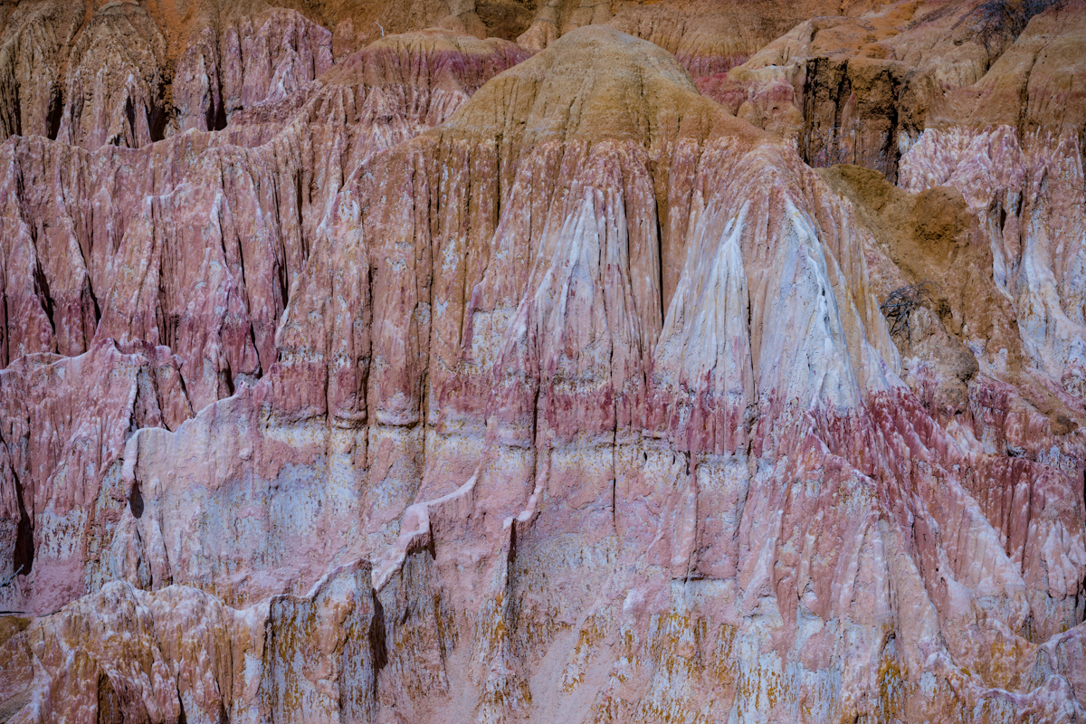
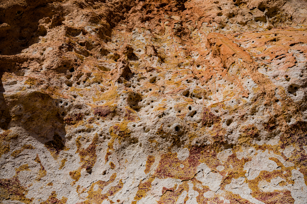
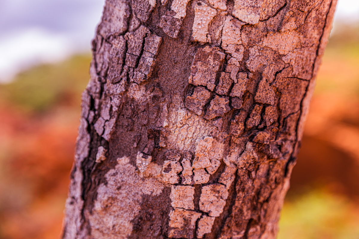
Close-up photographs of the rock surfaces can reveal:
- Erosion patterns.
- Exposed sedimentary layers.
- Surface textures.
- Contrasting colours.
- Weathered edges.
- Natural channels and gullies.
These photographs would also provide educational value when accompanying the geology section of the article.
Human-scale photography
Photographs showing a local guide within the landscape can help visitors appreciate the scale of the formations.
Such images should be made with the guide’s informed permission.
Community documentary photography
The community is central to the Marafa story.
A documentary sequence could include local guides, visitor management activities, conservation initiatives and the relationship between the attraction and the surrounding village.
Portraits should be taken with consent, and culturally sensitive activities should only be photographed when permission is granted.
Sunset photography
Sunset is one of the most visually rewarding periods.
Photographers should pay attention to:
- Direction of sunlight.
- Changing shadows.
- Exposure across contrasting rock surfaces.
- Silhouettes.
- Wide compositions.
- Details of the rock formations.
A tripod may be useful in certain conditions, but it should never be positioned where it obstructs the walking route or creates a safety risk.
Wildlife and the surrounding environment
The wider Marafa landscape can also provide opportunities to document vegetation, birds and other wildlife.
Baboons have been reported in the vicinity, although their presence should not be assumed during every visit.
Photographers should observe wildlife from a safe distance and avoid feeding or approaching animals.
Drone photography
Do not assume that a drone can be flown simply because the attraction is an open natural landscape.
Before any drone operation, check the applicable Kenya Civil Aviation Authority requirements, any relevant permits and the site’s own permissions.
Commercial filming and organised photographic productions should also be discussed with the management in advance.
Respecting the location
Photography should not compromise the safety of visitors, the integrity of the geological formations or the privacy of local residents.
Do not climb unstable structures, remove geological material or leave equipment and rubbish behind.
For Antony Trivet Photography, the objective should be original documentary coverage that tells the story of Marafa through its landscape and people.
16. What else can you visit around Marafa?
A visit to Marafa can be combined with other destinations in Kilifi County, particularly for travellers staying in Malindi or Watamu.
However, these destinations should be planned according to their actual distances and opening arrangements rather than presented as though they are all within walking distance of one another.
Mambrui Sand Dunes
The Mambrui Sand Dunes offer a contrasting landscape of coastal sand formations.
The dunes provide opportunities for landscape photography and outdoor activities.
They are an interesting addition to an itinerary exploring the geographical diversity of the Malindi region.
Visitors should confirm access arrangements, activity operators, charges and any applicable safety requirements before participating in activities such as quad biking.
Vasco da Gama Pillar, Malindi
The Vasco da Gama Pillar is one of Malindi’s prominent historical landmarks.
It provides an opportunity to explore the town’s maritime history and its historical connections with Portuguese navigation along the East African coast.
The monument is an important part of the historical landscape of Malindi.
Gede Ruins
The Gede Ruins are the remains of a historic Swahili settlement surrounded by forest.
The site provides an important contrast to Marafa, shifting the visitor’s attention from geological history to architecture, settlement patterns and the history of coastal civilisation.
Visitors interested in Kenya’s coastal heritage can learn about the settlement’s architecture, material culture and historical development.
Sabaki River Estuary
The Sabaki River Estuary is an interesting destination for visitors interested in coastal ecosystems, birdlife and riverine environments.
The estuary provides a different natural setting from the exposed sandstone formations of Marafa.
It is particularly relevant to nature photographers and birdwatchers interested in the relationship between freshwater and coastal ecosystems.
Watamu and Malindi beaches
Visitors can also combine a trip to Marafa with the beaches and coastal attractions of Watamu and Malindi.
These destinations provide accommodation, restaurants, marine activities and other visitor facilities.
The combination of coastal and inland destinations makes the region particularly interesting for travellers wanting to explore more than Kenya’s conventional beach attractions.
Planning a combined excursion
A visit to Marafa should not be rushed simply to accommodate too many destinations in one day.
If the objective is to experience the depression properly, allow sufficient time for the local guide, walking route and sunset.
Other destinations can be explored on separate days or incorporated into a wider itinerary.
17. Responsible tourism at Marafa Hell’s Kitchen
The future of Marafa depends partly on how its natural and cultural resources are managed.
The attraction’s landscape is continually modified by erosion, while tourism and surrounding land use create additional management considerations.
Visitors have a responsibility to minimise their impact.
Respect the geological formations
Do not break, remove or deliberately damage the sandstone.
Avoid climbing fragile formations or walking along unsupported edges.
Respect local culture
Nyari has cultural associations that extend beyond tourism.
Listen to local guides and seek permission before photographing residents or culturally significant activities.
Support community-managed tourism
Use the established local visitor arrangements and engage local guides.
This helps support the community’s participation in the tourism economy.
Avoid littering
Carry your waste out of the attraction and dispose of it responsibly.
Do not leave plastic bottles, food packaging or other waste within the gullies.
Respect conservation restrictions
If an area is closed, follow the restriction.
A temporary closure may be necessary because of erosion, safety concerns or conservation activities.
Do not treat folklore as entertainment detached from its cultural context
The stories surrounding Marafa form part of the community’s oral heritage.
Visitors should approach them with curiosity and respect rather than dismissing them or presenting them as geological facts.
Avoid removing plants and geological material
The natural environment is part of the attraction’s heritage.
Visitors should not collect rocks, plants or other natural materials as souvenirs.
The collection of traditional medicinal plants should also not be treated as an ordinary visitor activity.
Support responsible local businesses
Where appropriate, use locally managed guiding and visitor services.
Visitors can contribute to community-based tourism without making assumptions about how every payment is distributed.
Conservation is a shared responsibility
The community management organisation has a role in protecting the attraction, but visitors also influence its long-term condition.
Responsible behaviour helps preserve the landscape for future generations.
18. Is Marafa Hell’s Kitchen worth visiting?
For travellers interested in Kenya’s natural landscapes, geology, cultural heritage and lesser-known destinations, Marafa is worth considering.
It offers an experience that differs considerably from the familiar attractions of Kenya’s coastal tourism circuit.
The unusual sandstone formations provide an extraordinary visual landscape, while the local stories and community involvement give the attraction a cultural dimension.
It is also a useful reminder that Kenya’s natural heritage extends beyond its internationally recognised national parks, wildlife reserves and beaches.
However, visitors should arrive with realistic expectations.
Marafa is not a fully developed national park with extensive visitor infrastructure. It is a community-managed natural attraction whose access arrangements, walking routes and facilities need to be confirmed locally.
The heat and changing terrain also mean that a visit requires preparation.
Its greatest value is the combination of landscape, local knowledge and community participation.
For photographers, it provides an opportunity to document an unusual geological environment. For cultural travellers, it offers an introduction to the traditions and oral histories associated with Nyari. For visitors exploring Kilifi County, it provides another perspective on the geographical diversity of coastal Kenya.
Who would particularly enjoy visiting Marafa?
Marafa is particularly interesting for:
- Travellers interested in unusual geological landscapes.
- Landscape and documentary photographers.
- Visitors exploring the Malindi and Watamu region.
- Cultural travellers interested in Giriama heritage.
- Educational groups interested in geography and environmental studies.
- Visitors interested in community-based tourism.
- Travellers seeking destinations beyond the conventional beach experience.
Who should plan more carefully?
Visitors with mobility limitations, families with very young children and travellers who struggle with heat should discuss the walking conditions with local management before deciding to descend.
The attraction can still be appreciated from appropriate viewpoints without assuming that every visitor must complete the entire walking route.
19. Frequently asked questions about Marafa Hell’s Kitchen
Where is Marafa Hell’s Kitchen located?
Marafa Hell’s Kitchen is located near Marafa village in Magarini Sub-County, Kilifi County, Kenya. It is approximately 30–40 kilometres from Malindi.
What is the local name for Hell’s Kitchen?
The attraction is locally known as Nyari. Published translations include natural sacred depression and the place broken by itself, although the precise linguistic interpretation requires local verification.
Why is Marafa called Hell’s Kitchen?
The popular name is associated with the intense heat experienced within the exposed depression during hot periods of the day.
How was Hell’s Kitchen formed?
It is an erosional landscape associated with the Marafa geological formations. Weathering and erosion have shaped the exposed sedimentary materials into gullies, ridges, walls and unusual rock structures.
Is Marafa a volcanic crater?
No. The geological documentation reviewed identifies the Marafa formations in association with sedimentary materials and erosion, not volcanic crater formation.
How deep is Marafa Hell’s Kitchen?
A reliable, independently verified measurement of the entire depression’s maximum depth has not been established in the information reviewed. Visitors should be cautious about unsupported measurements published online.
How far is Hell’s Kitchen from Malindi?
It is approximately 30–40 kilometres from Malindi, depending on the route. Allow roughly 45 minutes to one hour by road.
What is the best time to visit Marafa?
Early morning and late afternoon are generally the most suitable periods. Sunset is particularly popular because of the warm light across the exposed formations.
How much is the entrance fee?
The current entrance fee should be confirmed directly with the Marafa Hell’s Kitchen Tour Operators organisation. Online prices vary and may be outdated.
Do you need a guide?
Hiring a local guide is strongly recommended. Guides explain the landscape, share local traditions and help visitors navigate changing walking routes.
How long does a visit take?
Allow approximately two to three hours for a guided visit, exploration, photography and returning to the entrance.
Can children visit Hell’s Kitchen?
Yes, but the terrain can be challenging. Children require close supervision, particularly around exposed edges and steep walking sections.
Is Marafa suitable for elderly visitors?
Some upper viewpoints may be more manageable, but the descent can be difficult. Visitors should discuss accessibility with local management before travelling.
Can you visit Marafa during the rainy season?
A visit may be possible, but heavy rainfall can affect the walking routes and road conditions. Confirm access with the local management before departure.
Is there accommodation at Marafa?
Malindi is the most practical accommodation base. Visitors can also consider Watamu, depending on their itinerary.
Can you visit Marafa without a private vehicle?
Yes, public transport connections are described in travel guides, but schedules and return arrangements should be verified. A private transfer is more convenient, particularly for sunset visits.
Is Marafa Hell’s Kitchen a protected area?
The attraction is community-managed and has been subject to conservation and boundary-management initiatives. A specific formal gazettement instrument has not been established in the information reviewed for this article.
How large is Marafa Hell’s Kitchen?
Recent reporting gives an approximate figure of 210 acres for the community-managed attraction. This should not be interpreted as a verified measurement of the exposed geological depression alone.
Can photographers use drones at Marafa?
Drone operations should only take place after confirming applicable aviation requirements, relevant permissions and site restrictions.
Are there animals at Marafa Hell’s Kitchen?
The wider environment supports wildlife, and baboons have been reported around the attraction. Wildlife sightings are not guaranteed, and visitors should maintain a safe distance from animals.
What makes Marafa different from other Kenyan attractions?
Its distinctive combination of exposed sedimentary formations, erosional gullies, unusual geological colours, Giriama oral traditions and community-managed tourism makes it different from the better-known coastal and wildlife attractions.
Can Marafa be visited as a day trip from Watamu?
Yes. Visitors staying in Watamu can arrange a day excursion through Malindi towards Marafa. Private transport is particularly useful if the visit is planned around sunset.
20. Conclusion: Marafa, a landscape shaped by nature and remembered through culture
Marafa Hell’s Kitchen is one of the most distinctive geological attractions in Kilifi County.
Its unusual sandstone formations provide evidence of the natural processes that have shaped the coastal hinterland over geological time. Its legends and local traditions reveal how communities have interpreted the landscape and incorporated it into their cultural memory.
The attraction also demonstrates the importance of community participation in managing natural heritage and developing tourism opportunities in rural Kenya.
Its continuing erosion and the need for responsible site management are reminders that the landscape is not static.
For visitors, Marafa offers an opportunity to experience a different side of coastal Kenya.
For documentary photographers, it presents an opportunity to record the relationship between geology, culture, people and the environment.
For Antony Trivet Photography, documenting Marafa means going beyond the familiar image of a colourful canyon at sunset.
It means recording the landscape accurately, listening to local voices, respecting cultural heritage and telling a story that will remain useful to future travellers.
Marafa is not simply a place to photograph. It is a place to understand.
Documented by Antony Trivet Photography — Kenya Travel Documentary Series.